Cattle pond
| Cattle pond | ||
|---|---|---|

|
||
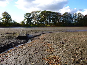
| Cattle pond after the water was drained and an old boat at the inflow | ||
| Geographical location | Plön district | |
| Location close to the shore | Dosenbek , Kiel | |
| Data | ||
| Coordinates | 54 ° 10 '27 " N , 10 ° 8' 28" E | |
|
|
||
| surface | 7.7 ha | |
| scope | 1.56 km | |
| Maximum depth | 1.0 m | |
| Middle deep | 0.57 m | |
The Viehteich is a lake in the district of Plön in the German state Schleswig-Holstein north of the village of Dosenbek . It is about 8 hectares in size. The Bothkamper and Hochfelder See lakes are around 1.7 kilometers to the north .
The lake is used for fish farming, especially carp , and the water is drained annually.
See also
Commons : Viehteich - Collection of pictures, videos and audio files
Individual evidence
- ^ Ministry of Agriculture, Environment and Rural Areas Schleswig-Holstein: Lakes. Retrieved November 2, 2010 .
