Vignole
| Vignole | ||
|---|---|---|
| Vignole to the right of the center of the picture, top left: Venice | ||
| Waters | Venice lagoon | |
| Geographical location | 45 ° 26 '24 " N , 12 ° 22' 30" E | |
|
|
||
| surface | 13.6 ha | |
| Residents | 69 (2001) 507 inhabitants / km² |
|
| Le Vignole | ||
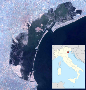
Vignole is a small island in the Venice lagoon and is located south of the island of Sant'Erasmo . It covers an area of 69.20 hectares. For the 2001 census, 69 permanent residents were found in scattered residential buildings. It can be reached with the vaporetto line 13.
Like the island of Sant'Erasmo, Vignole serves to supply the city of Venice by growing vegetables . In addition to a few private houses, there is currently (2005) a trattoria on the island .
There is also a large wood storage area on the island, where mainly the “briccole”, the orientation and mooring poles rammed into the sand and mud of the lagoon, are stored, tarred and impregnated.
Fortresses
To the east of the island of Vignole and separated from it by a 10 to 30 meter wide channel is the island of Sant'Andrea , and to the south, separated by a 30 to 40 meter wide channel, the island of La Certosa . Mighty armored gates in the fortress built by the architect Michele Sanmicheli testify to the defensive will of the Venetians. Together with the fortresses on S.Nicolò di Lido, these formed a barely passable barrier for intruders from the open sea. The mighty brick buildings were partially destroyed by the forces of the water, a ditch formed by erosion almost 30 meters deep caused parts of the masonry to sag.
Airfield
The eastern part of the island is shaped by the former sea airfield, which dates from the time of the First World War. Civil flying boats were also handled here in the interwar period . Together with the neighboring Venice-Lido airport , it served to handle commercial air traffic. After the Second World War, the Italian military turned the striking facility into a base for the Lagunari , an amphibious force.
Web links
Remarks
- ↑ ISTAT data
- ↑ On the top picture in the info box, the grass runway of the Venice-Lido airport can be seen in the foreground. To the right of the center of the picture, the end of a canal is surrounded by buildings on the neighboring Vignole Island. The canal and other facilities were used as a torpedo testing facility from 1884 and converted into a seaplane base in 1913. Although the former handling facilities were located on Vignole, the seaplane base was named after the small island of Sant'Andrea, which can be seen as the southern continuation of Vignole. Today's Lagunari base is also often named after the fortress island of Sant'Andrea. “Sant'Andrea” sea airfield on forgottenairfields.com


