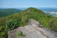
Vihorlatské vrchy
Coordinates: 48 ° 55 ' N , 22 ° 10' E

The Vihorlatské vrchy (German the Vihorlat or the Vihorlat Mountains ) are 55 kilometers long and up to 11 kilometers wide, between 400 and 1100 meters high, volcanic, wooded mountains in southern eastern Slovakia . The highest elevation is the Vihorlat with 1076 meters, other striking elevations are the Nežabec (1023 m), the Sninský kameň (1005 m), the Lysák (821 m) and the Trislák (772 m).
The primeval forest areas of the same name in the eastern part of the mountain are protected as the Vihorlat landscape protection area, while the western part is the restricted military area Valaškovce . In the eastern part is the Vihorlatský prales primeval forest, which has been part of the UNESCO World Heritage "Primeval Beech Forests in the Carpathians " since 2007 . The starting points for the circular route through the accessible part of the Vihorlat Mountains are Zemplínske Hámre in the north and Remetské Hámre in the south. The attraction for many tourists is the 618 m high lake Morské oko ( lake eye ) below the Okna source.
The mountain is on the border of the Regional Associations ( kraje ) Prešovský kraj and Košický kraj .


