Zemplínske Hámre
| Zemplínske Hámre | ||
|---|---|---|
| coat of arms | map | |

|
|
|
| Basic data | ||
| State : | Slovakia | |
| Kraj : | Prešovský kraj | |
| Okres : | Snina | |
| Region : | Horný Zemplín | |
| Area : | 8.45 km² | |
| Residents : | 1,261 (Dec 31, 2019) | |
| Population density : | 149 inhabitants per km² | |
| Height : | 347 m nm | |
| Postal code : | 067 77 | |
| Telephone code : | 0 57 | |
| Geographic location : | 48 ° 57 ' N , 22 ° 9' E | |
| License plate : | SV | |
| Kód obce : | 521108 | |
| structure | ||
| Community type : | local community | |
| Administration (as of November 2018) | ||
| Mayor : | Ján Kepič | |
| Address: | Obecný úrad Zemplínske Hámre Hlavná 152/183 06777 Zemplínske Hámre |
|
| Website: | www.zemplinskehamre.sk | |
| Statistics information on statistics.sk | ||
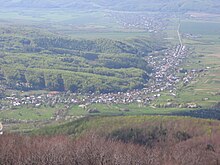
Zemplínske Hámre (until 1956 in Slovak "Sninské Hámre"; German Josefhammer , Hungarian Józsefhámor - until 1844 Józsefvölgy - then also Szinna Hámor ) is a municipality in eastern Slovakia .
The place was only created south of Snina at the end of the 18th century. The entrepreneur Joseph Rholl , who came from the Spiš , found rich iron ore and silicate deposits in the mountains of Vihorlat . To develop the deposits he had a hammer mill built and for this purpose settled workers mainly from the places Göllnitz , Margarethen , Rhollhütte (today part of Margecany) and other places in this Spiš area. The result was a typical early industrial workers' settlement, which was officially called Josefsthal from 1809 (Slovak Jozefova dolina , Hungarian Józsefvölgy ).
Due to the decline of the metallurgy at the end of the 1880s, many residents of the place emigrated (1877: 417 inhabitants, 1903: 323 inhabitants, 1918: 128 inhabitants). The rest of the inhabitants tried their hand at agriculture and charcoal burning .
In 1901 a chapel was built in the village, in 1963 a church dedicated to Joseph the worker .
Web links
- Interesting facts about the history (PDF file; 137 kB)

