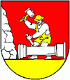
Belá nad Cirochou
| Belá nad Cirochou | ||
|---|---|---|
| coat of arms | map | |

|
|
|
| Basic data | ||
| State : | Slovakia | |
| Kraj : | Prešovský kraj | |
| Okres : | Snina | |
| Region : | Horný Zemplín | |
| Area : | 17.348 km² | |
| Residents : | 3,399 (Dec. 31, 2019) | |
| Population density : | 196 inhabitants per km² | |
| Height : | 211 m nm | |
| Postal code : | 067 81 | |
| Telephone code : | 0 57 | |
| Geographic location : | 48 ° 58 ′ N , 22 ° 6 ′ E | |
| License plate : | SV | |
| Kód obce : | 520039 | |
| structure | ||
| Community type : | local community | |
| Administration (as of November 2018) | ||
| Mayor : | Jan Vajda | |
| Address: | Obecný úrad Belá nad Cirochou Osloboditeľov 23 06781 Belá nad Cirochou |
|
| Website: | www.belanadcirochou.sk | |
| Statistics information on statistics.sk | ||
Belá nad Cirochou (until 1927 "Cirocká Belá" in Slovak; Cirókabéla in Hungarian ) is a municipality in eastern Slovakia .
location
It is located in the Cirocha Valley, at the foot of the Vihorlat Mountains , on the main road I / 74, 4 km west of Snina and 18 km east of Humenné . The main road I / 74, which connects the two cities, continues to the Ukrainian border.
history
The place was first mentioned in 1451. There is a Roman Catholic church in the village from 1912.
Web links
Commons : Belá nad Cirochou - collection of images, videos and audio files
