
Wangermeer
| Wangermeer | ||
|---|---|---|

|
||
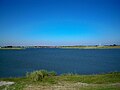
| Wangermeer from the north, with round island, May 2013 | ||
| Geographical location | Wangerland municipality , Friesland district , Lower Saxony | |
| Tributaries | - | |
| Drain | - | |
| Islands | Round island | |
| Places on the shore | Hohenkirchen | |
| Location close to the shore | Jever , Wilhelmshaven | |
| Data | ||
| Coordinates | 53 ° 40 '15 " N , 7 ° 54' 49" E | |
|
||
| surface | 1 km² | |
|
particularities |
Artificially created lake |
|

The Wangermeer is an approximately 100 hectare man-made recreational lake in the municipality of Wangerland in north-western Lower Saxony .
description
The Wanger sea on the northern outskirts of Hohenkirchen was created by clay mining in the course of dike raising measures in Elizabeth Groden by the III. Oldenburg dike tape . To develop the northern side of the lake, a 325-meter-long bridge promenade was built across the lake for pedestrians and cyclists, which, due to its height, makes it possible for small sailing boats to pass under it. The municipality plans to use it for tourism in the future. The key point is a hiking and cycling path around the lake. An ecologically valuable shallow water zone is to be created in the northeast of the lake.
Picture gallery
View from the football golf course over the Wangermeer with the bridge in the background, July 2014

Northern bay
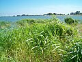
Belt of reeds on the circular route

View from the north of Hohenkirchen, May 2013


See also
Web links
Individual evidence
- ↑ a b Wangerland-Online: Das Wangermeer , accessed on September 7, 2012
- ↑ Wangermeer grows by another five hectares , accessed on September 7, 2012
- ^ Hohenkirchen: The Wangermeer concept is available , accessed on September 7, 2012