Werndlfing
|
Werndlfing
Municipality of Erding
Coordinates: 48 ° 17 ′ 20 ″ N , 11 ° 52 ′ 19 ″ E
|
||
|---|---|---|
| Height : | 481 m above sea level NHN | |
| Residents : | 19 (2017) | |
| Postal code : | 85435 | |
| Area code : | 08122 | |
|
Location of Werndlfing in Bavaria |
||
|
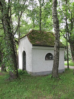
Werndlfing Chapel
|
||
Werndlfing is a district of the city of Erding in Upper Bavaria .
location
The place is about four kilometers southwest of Erding. The federal highway 388 runs 300 meters south of the village .
Architectural monuments
In Werndlfing there is a chapel from 1914.
Web links
Commons : Werndlfing - Collection of images, videos and audio files

