Wilbur Lake, Tennessee
| Wilbur Lake Wilbur Dam |
|||||||||
|---|---|---|---|---|---|---|---|---|---|
| Wilbur Lake dam | |||||||||
|
|||||||||
|
|
|||||||||
| Coordinates | 36 ° 20 ′ 27 ″ N , 82 ° 7 ′ 10 ″ W | ||||||||
| Data on the structure | |||||||||
| Construction time: | 1909-1912 | ||||||||
| Height of the barrier structure : | 23.2 m | ||||||||
| Crown length: | 114.3 m | ||||||||
| Power plant output: | 11 MW | ||||||||
| Operator: | Tennessee Valley Authority (TVA) | ||||||||
| Data on the reservoir | |||||||||
| Altitude (at congestion destination ) | 503 m | ||||||||
| Water surface | 29 hectares | ||||||||
| Total storage space : | 881 900 m³ | ||||||||
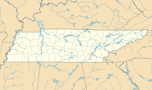
Wilbur Lake (also Wilbur Reservoir ) is a small reservoir on the Watauga River in northeast Tennessee , United States .
It is located east of Elizabethton in Carter County , just before the Watauga River leaves the Iron Mountains , an Appalachian mountain range.
The reservoir was created by the Wilbur Dam, which was built from 1909 to 1912 . This concrete dam is 23.2 m high and 114.3 m long, the lake has an area of 29 ha. The dam is used to generate electricity and has four generators with an output of 11 MW. The facility has been owned by the Tennessee Valley Authority (TVA) since 1945 .
A few kilometers above Wilbur Lake , the TVA completed the much larger Watauga Dam in 1948 . The Watauga Lake created there is almost 90 times larger than Wilbur Lake at 26 km² .

