Wildstrubel Glacier
| Wildstrubel Glacier | ||
|---|---|---|
|
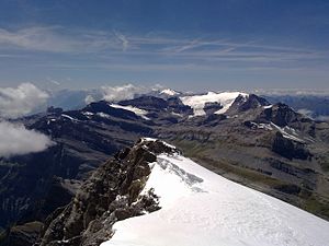
Wildstrubel with Wildstrubel Glacier (right of the center of the picture) from the east, from the Rinderhorn |
||
| location | Canton of Valais , Switzerland | |
| Mountains | Bernese Alps | |
| Type | Mountain glacier | |
| length | 2.3 km (2011) | |
| surface | 3.15 km² (1992) | |
| Exposure | east | |
| Altitude range | 3240 m above sea level M. - 2540 m above sea level M. (2005) | |
| Tilt | ⌀ 18.2 ° (33%) | |
| Ice volume | 0.15 ± 0.04 km³ (1992) | |
| Coordinates | 608564 / 138744 | |
|
|
||
| drainage | Lämmerendalu, Daubensee | |
The Wildstrubelgletscher or Lämmerngletscher is a glacier in the Bernese Alps , in the canton of Valais , Switzerland . In 2011 it had a length of 2.3 km, since 1917 it has lost around 450 m in length. The area for 1992 was given as 3.15 km².
The Wildstrubel Glacier takes its starting point on the southeast flank of the Wildstrubel massif between the actual Wildstrubel and the Middle Summit at over 3200 m . The glacier flows as a wide ice stream to the east, flanked by the Schneehorn ( 3178 m above sea level ) in the south and the Grossstrubel ( 3243 m above sea level ) in the north. The glacier tongue currently ends at an altitude of around 2540 m . The Lämmerendalu rises here and drains the valley to the Daubensee .
The Wildstrubel Glacier is separated from the Plaine Morte Glacier further south by the ridge that runs from the Weststrubel ( 3244 m above sea level ) in a south-easterly direction to the Schneehorn. In the past, the eastern part of the Plaine Morte Glacier to the south of this ridge was called the “Wildstrubel Glacier” and the glacier, which is now called “Lammern Glacier”, was called the “Lämmern Glacier”.
In his high stage during the Little Ice Age in the mid-19th century, the Wildstrubel glacier known as something extended lambs glacier further down the valley, and was with the Black Horn down flowing lambs glacier connected. The Steghorn Glacier also extended to the Wildstrubel Glacier during this time.
Web links
- Wildstrubel Glacier on the ETHorama platform
- Map section at map.geo.admin.ch
Individual evidence
- ↑ a b Research Institute for Hydraulic Engineering, Hydrology and Glaciology (VAW) of the ETH Zurich (ed.): Wildstrubel Glacier. In: Swiss Glacier Measurement Network. ( ethz.ch , also as PDF , accessed on March 6, 2014).
- ↑ a b c Daniel Farinotti, Matthias Huss, Andreas Bauder, Martin Funk: An estimate of the glacier ice volume in the Swiss Alps. In: Global and Planetary Change. 68: 225-231, 2009 ( online ; PDF; 756 kB).
- ^ WGMS: Fluctuations of Glaciers Database. World Glacier Monitoring Service, Zurich 2013 ( DOI: 10.5904 / wgms-fog-2013-11 ), accessed on December 11, 2013
- ↑ Andreas Linsbauer, Frank Paul, Wilfried Haeberli: Modeling glacier thickness distribution and bed topography over entire mountain ranges with GlabTop: Application of a fast and robust approach. In: Journal of Geophysical Research. , Volume 117, F03007, 2012, doi : 10.1029 / 2011JF002313 ( online )
- ^ Charles Knapp, Maurice Borel, Victor Attinger, Heinrich Brunner, Société neuchâteloise de geographie (editor): Geographical Lexicon of Switzerland . Volume 6: Tavetsch Val - Zybachsplatte, supplement - last additions - appendix . Verlag Gebrüder Attinger, Neuenburg 1910, p. 652, keyword Wildstrubelmassiv ( scan of the lexicon page ).

