
Wood Lake, British Columbia
| Wood Lake | ||
|---|---|---|
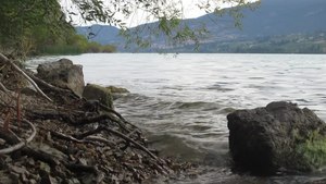
| Looking north on the west bank of Wood Lake in summer, the haze in the sky comes from nearby forest fires | ||
| Geographical location | Okanagan Valley , British Columbia (Canada) | |
| Tributaries | Vernon Creek | |
| Drain | Vernon Creek to Kalamalka Lake | |
| Places on the shore | Lake Country | |
| Data | ||
| Coordinates | 50 ° 5 ′ 0 ″ N , 119 ° 23 ′ 0 ″ W | |
|
||
| Altitude above sea level | 391 m | |
| surface | 9 km² | |
| volume | 0.199.5 km³ | |
| scope | 13.5 km | |
| Maximum depth | 34 m | |
| Middle deep | 21.5 m | |
|
particularities |
Catchment area 190 km² |
|

The Wood Lake is a lake in a chain of five major lakes, the parts of the Okanagan Valley in the interior of the Canadian province of British Columbia dominate. The lakes of the Okanagan Valley were formed about 8,900 years ago. Wood Lake is immediately south of Kalamalka Lake ; the two lakes were connected by a canal (the Oyama Canal) in 1908. Located between Oyama and Winfield, two boroughs of Lake Country, it has a solid reputation among anglers keen to catch rainbow trout . The lake is named after Tom Wood, who settled at the southern end of the lake around 1860.
The dry climate and fertile soil has encouraged the development of a mature fruit industry around the lake and throughout the valley. The upper catchment area is heavily forested and has been cut down for decades. The lower areas are described as the yellow pine / tussock area.
Physical data
- Normal annual water level fluctuations: 1.2 m
- Number of beaches: 4
There is also a Wood Lake in the Fraser Valley , an area of British Columbia.
gallery
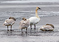
One adult and two juvenile Trumpeter Swans on the shores of Wood Lake near Oyama, British Columbia
Loons swimming in Wood Lake on a summer morning


Individual evidence
- ↑ a b c Wood Lake . In: BC Geographical Names (English)
- ^ World Lake Database (Wood Lakes) . International Lake Environment Committee Foundation (ILEC). Archived from the original on March 6, 2016. Info: The archive link was inserted automatically and has not yet been checked. Please check the original and archive link according to the instructions and then remove this notice. Retrieved August 6, 2015: "the lakes of the Okanagan Valley were formed by about 8900 BP"
swell
- Anonymous (1974a). Kalamalka-Wood Lake Basin Water Resource Management Study. Water Investigations Branch, British Columbia Water Resources Service, Victoria , BC, 209 S.
- Anonymous (1974b). Limnology of the Major Lakes in the Okanagan Basin. Canada - British Columbia Okanagan Basin Agreement, Final Report, Technical Supplement V. British Columbia Water Resources Service, Victoria, British Columbia, 261 pp.
- Anonymous (1974c). The Main Report of the Consultative Board. Canada - British Columbia Okanagan Basin Agreement. British Columbia Water Resources Service, Victoria, British Columbia.
- Stockner, JG & Northcote, TG (1974). Recent limnological studies of Okanagan Basin lakes and their contribution to comprehensive water resource planning. Journal of the Fisheries Research Board of Canada, 31, pp. 955-976.
- Walker, IR, ED Reavie, S. Palmer & RN Nordin, 1993. A palaeoenvironmental assessment of human impact on Wood Lake, Okanagan Valley, British Columbia. Quaternary International 20: 51-70.