Wustrowsee
| Wustrowsee | ||
|---|---|---|

|
||
| Geographical location | Ludwigslust-Parchim district | |
| Tributaries | from Lake Superior | |
| Drain | to the mayor lake | |
| Location close to the shore | Sternberg | |
| Data | ||
| Coordinates | 53 ° 41 ′ 45 " N , 11 ° 47 ′ 33" E | |
|
|
||
| Altitude above sea level | 31.6 m above sea level NHN | |
| surface | 35.3 ha | |
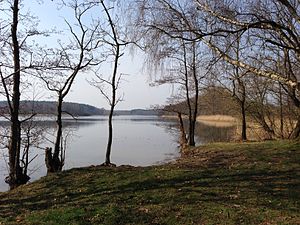
The Wustrowsee is located west of the town of Sternberg in the Ludwigslust-Parchim district in Mecklenburg-Western Pomerania . The name Wustrow is derived from Slavic and means "island". The lake name means island lake and probably refers to the seagull island in the middle of the lake. The lake has a length of about 1200 meters and a maximum width of about 500 meters. The water has two distinctive bays on the southeast side and one at the north end of the lake. The drain towards the Bürgermeistersee is also located here.
The lake and its surroundings are part of the FFH area Obere Seen and Wendfeld (near Sternberg) .
See also
proof
- ↑ Geodata viewer of the Office for Geoinformation, Surveying and Cadastre of Mecklenburg-Western Pomerania ( information )
- ↑ Standard data sheet FFH area Obere Seen and Wendfeld (near Sternberg) (PDF; 48 kB)
Web links
Commons : Wustrowsee - Collection of images, videos and audio files
