Nevado de Toluca
| Nevado de Toluca | ||
|---|---|---|
|
Nevado de Toluca with a snowy peak |
||
| height | 4690 m | |
| location | Texcaltitlán , México , Mexico | |
| Mountains | Sierra Volcánica Transversal | |
| Dominance | 118.39 km → Popocatépetl | |
| Notch height | 2240 m | |
| Coordinates | 19 ° 6 '23 " N , 99 ° 45' 32" W | |
|
|
||
| Type | Stratovolcano | |
| Last eruption | approx. 1350 BC Chr. | |
| particularities | fourth highest mountain in Mexico | |
The Nevado de Toluca (also called Xinantécatl ) was long considered - after the Pico de Orizaba (5636 m), the Popocatépetl (5426 m) and the Iztaccíhuatl (5230 m) - with its 4690 m as the fourth highest mountain in Mexico . Only a few years ago it was established through satellite measurements and GPS that the Sierra Negra , a mountain neighboring the Pico de Orizaba, could be a few meters higher.
location
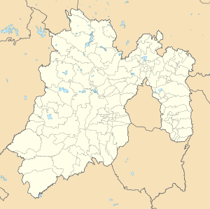
The Nevado de Toluca belongs to the western area of the Sierra Volcánica Transversal and rises about 30 km (as the crow flies) southwest of the city of Toluca de Lerdo , the capital of the state of México ; it is a good 100 km - also in a south-westerly direction - from Mexico City . A bumpy dirt road leads to just below the summit (Pico del Fraile) , which is still accessible for both cars and buses; the slope ends about 1.5 km from the south-western summit, about the same level as the two mountain lakes (4200 m). However, this section has been closed to traffic for years and the highest passable point is about 100 meters below and outside the northeastern crater rim ("Campamento Nevado de Toluca").
description
The Nevado de Toluca is a volcanic mountain, which has not been active for centuries, with three summit craters. The last eruption will be around the year 1350 BC. Estimated; the area around Toluca was covered by a meter-thick layer of stone and ash and even in the capital region it was still 50 cm. The former craters are filled with rain and melt water; the two crater lakes are popularly known as Lago del Sol ("sun lake") and Lago de la Luna ("moon lake"). In the winter months the mountain top is mostly snow-covered; in the summer heat the snow thaws completely and the summit looks stony and bare.
National park
As early as 1936, an area of 54,000 ha on the Xinantécatl and parts of its surrounding area was designated as a national park and thus placed under protection; the area has meanwhile been reduced to approx. 17,000 hectares. On the mountain, which - because of its large number of springs - was venerated as sacred by the pre-Columbian Indians, 18 archaeological sites with ceramic remains etc. have been discovered. In the 16th century, Bernardino de Sahagún reported on the mountain lakes as places where ceremonies were held and offerings - including copal resin - were made.
tourism
The volcano can be explored relatively easily by bike or car, there is a parking lot and mountain huts at an altitude of approx. 4200 m. However, the ascent can be strenuous due to the altitude, the heat (in the sun) or the cold (in the clouds). You need enough drinking water and good sun protection. The path is not marked and further up it is easy to get lost in clouds or fog. The best season to visit is winter, as the dry season and relatively stable weather conditions prevail in central Mexico, namely from November to April. During the transition to the rainy season, it can snow on the mountain in spring. According to this, the mountain is covered with snow for a few days or even weeks from January to April; then an inspection is not recommended. The best view is usually in the morning; Clouds often form in the afternoon.
See also
Web links
- Nevado de Toluca in the Global Volcanism Program of the Smithsonian Institution (English)
- Nevado de Toluca - photos + information
- Nevado de Toluca - Photo + Info (English)
Remarks
- ↑ The altitude information in the various sources varies between 4632 and 4700 m.


