
Yeina
| Yeina | ||
|---|---|---|
.JPG) |
||
| Waters | Solomon Lake | |
| Archipelago | Louisiade Archipelago | |
| Geographical location | 11 ° 19 ′ 49 ″ S , 153 ° 26 ′ 6 ″ E | |
|
||
| length | 9.5 km | |
| width | 3.2 km | |
| surface | 11 km² | |
| Highest elevation | 79 m | |
| Residents | 145 (2000) 13 inhabitants / km² |
|
| main place | Kabagi-bagi | |
 |
||

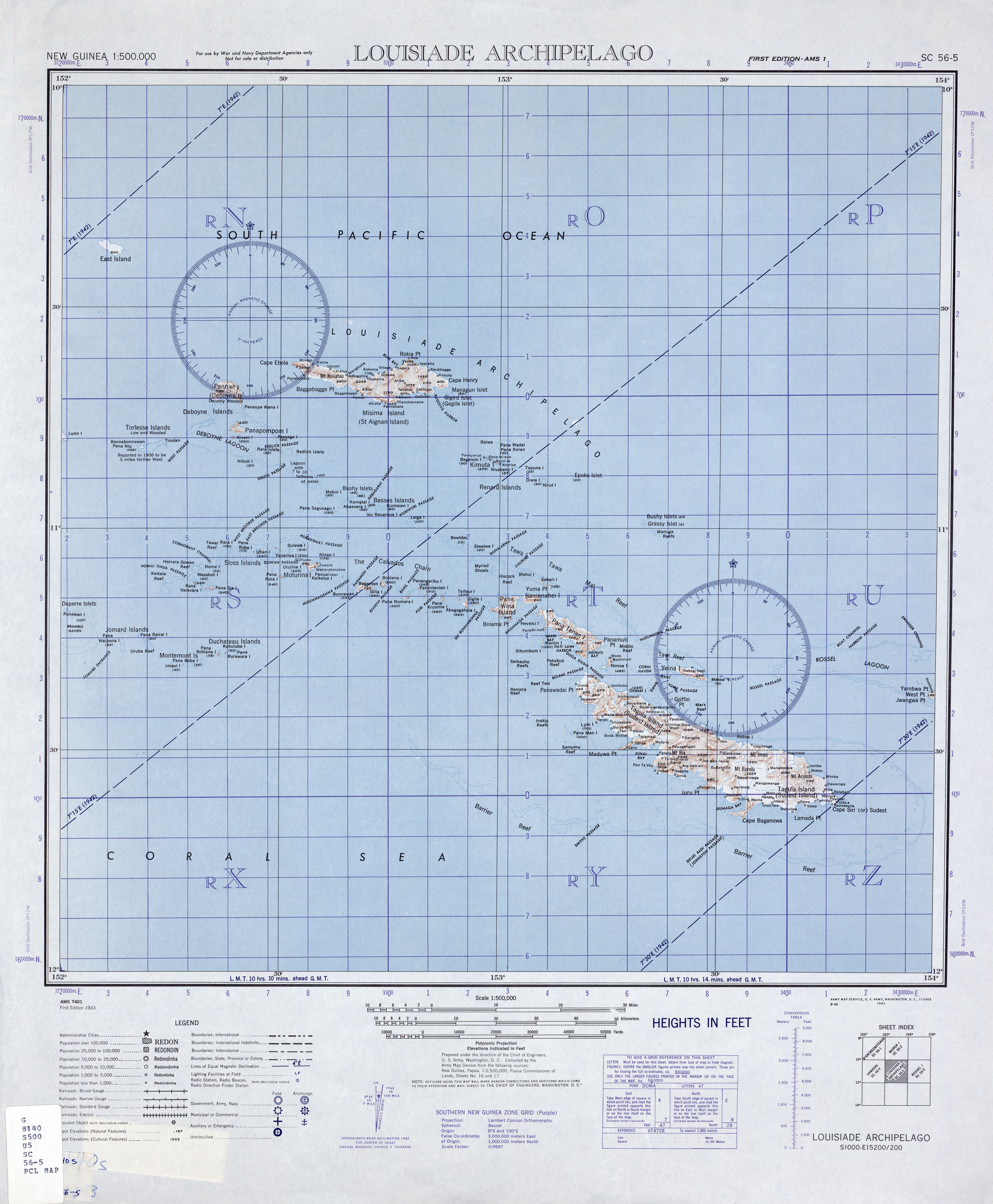
Yeina (Piron Island, Jeina or Veina Island, Yema Island) is an island of volcanic origin in the southeast of the Louisiade Archipelago in the Milne Bay province of Papua New Guinea . The island, fringed by coral reefs, is located 10 km northwest of Vanatinai (Tagula) at the eastern end of a reef.
The interior of the island is characterized by a chain of low, grassy hills surrounded by a coastal forest, which consists mainly of mangroves .
The Marx reef is located between Yeina and Vanatinai. A canal, the Yuma Passage, connects a partially enclosed lagoon north of Vanatinai, with the bay in the south of Yeina.
According to the 2000 census, the island had 145 inhabitants in 22 households.
On a topographic map from 1943 on a scale of 1: 500,000, Kabagi-bagi is the only place on the north coast.
Individual evidence
- ↑ Papua New Guinea WWWVL in Maps ( Memento from June 9, 2007 in the Internet Archive )
- ↑ US Army Map Service: SC 56-5 Louisiade Archipelago