Louisiade Archipelago
| Louisiade Archipelago | ||
|---|---|---|
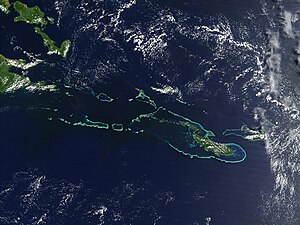
| Satellite image of the Louisiade Archipelago | ||
| Waters | Pacific Ocean | |
| Geographical location | 11 ° 0 ′ S , 153 ° 0 ′ E | |
|
|
||
| Number of islands | 90 | |
| Main island | Misima | |
| Total land area | 1600 km² | |
| Residents | 17,000 | |
| Map of the Louisiade Archipelago | ||
The Louisiade Archipelago is a group of islands in the extreme southeast of Papua New Guinea . The archipelago comprises around 90 islands and has a total area of 1600 km².
The archipelago belongs to the Milne Bay province .
geography
The archipelago lies on the border between the Coral Sea and Solomon Sea . The largest islands are Vanatinai (also Tagula or Sudest ) with an area of 867 km², Rossel (also Yela ) with an area of 260 km², Misima with an area of 200 km², Sideia with 107 km², Basilaki with 100 km², Pana Tinani with 78 km² and Panaete (also Deboyne ) with 30 km².
Sideia, Basilaki Island and the Dumoulin Islands are near the coast of New Guinea . Misima, Vanatinai, Rossel and the Duchateau Islands are further southeast.
- Archipelagos
In the archipelago are u. a. the following archipelagos or atolls :
- Bonvouloir Islands with the Strathord Islands subgroup
- Bramble Haven Atoll with the subgroup of the Duperré Islands
- Brumer Islands
- Calvados Islands with the sub-group of the Sloss Islands
- Conflict atoll
- Deboyne Islands
- Duchateau Islands
- Dumoulin Islands
- Engineer Islands
- Jomard Islands
- Lebrun Islands
- Obstruction Islands
- Renard Islands
- Stuers Islands
- Torlesse Atoll
geology
The islands are partly coralline and partly volcanic in origin.
population
The archipelago is home to around 17,000 residents.
The main town is Bwagaoia on the island of Misima .
Natural resources
There are gold deposits on the island of Misima .


