Yosan Line
|
|
|
|---|---|
|
a train on the Yosan Line
| |
|
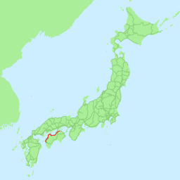
Card with red Yosan line
| |
| Route length: | 297th, 6 km |
| Gauge : | 1067 mm ( cape track ) |
| Power system : | 1500V = |
| Top speed: | 130 km / h |
The Yosan Line ( Japanese 予 讃 線 , Yosan-sen ) is a railway line on Shikoku Island in Japan . It is part of the line network of the Shikoku Railway Company (JR Shikoku) and runs on the northern side of the island and thus along the Seto Inland Sea . It connects the cities of Takamatsu (administrative city of Kagawa Prefecture ) and Matsuyama (administrative city of Ehime Prefecture ) and then continues to Uwajima . It is partly built with two lanes and partly electrified with 1500 volts direct current.
The first section was put into operation in 1889. Prior to 1988 the line was called the Yosan Main Line . It received its current name on the occasion of the privatization of the Japanese National Railways . In one section it is also called the Seto Ōhashi Line , but this line also leads to other routes.
The freight transport company JR Freight operates the 203.0 km route between Takamatsu and Iyo Yokota in Masaki .
Route data
- Length:
- Track width: 1067 mm (Cape Track)
- Stations:
- Passenger stations: 94 (stations and stops, including stops on demand)
- Freight station: 1 (Takamatsu Freight Terminal)
- Expanded to two lanes:
- Takamatsu - Tadotsu
- Electrified:
- Takamatsu - Iyoshi (with 1500 volts direct current)
- Security system: entire CTC line
- Top speed:
- Takamatsu - Matsuyama: 130 km / h
- Matsuyama - Uchiko, Iyo Iwaki - Unomachi: 120 km / h
- Others: 110 km / h

