
Zealandia Bank
| Zealandia Bank | ||
|---|---|---|
 Bathymetric map of the Zealandia Bank looking northeast |
||
| height | 2 m | |
| location | between Sarigan and Guguan | |
| Coordinates | 16 ° 53 ′ 40 ″ N , 145 ° 51 ′ 0 ″ E | |
|
||
| Type | submarine volcano | |

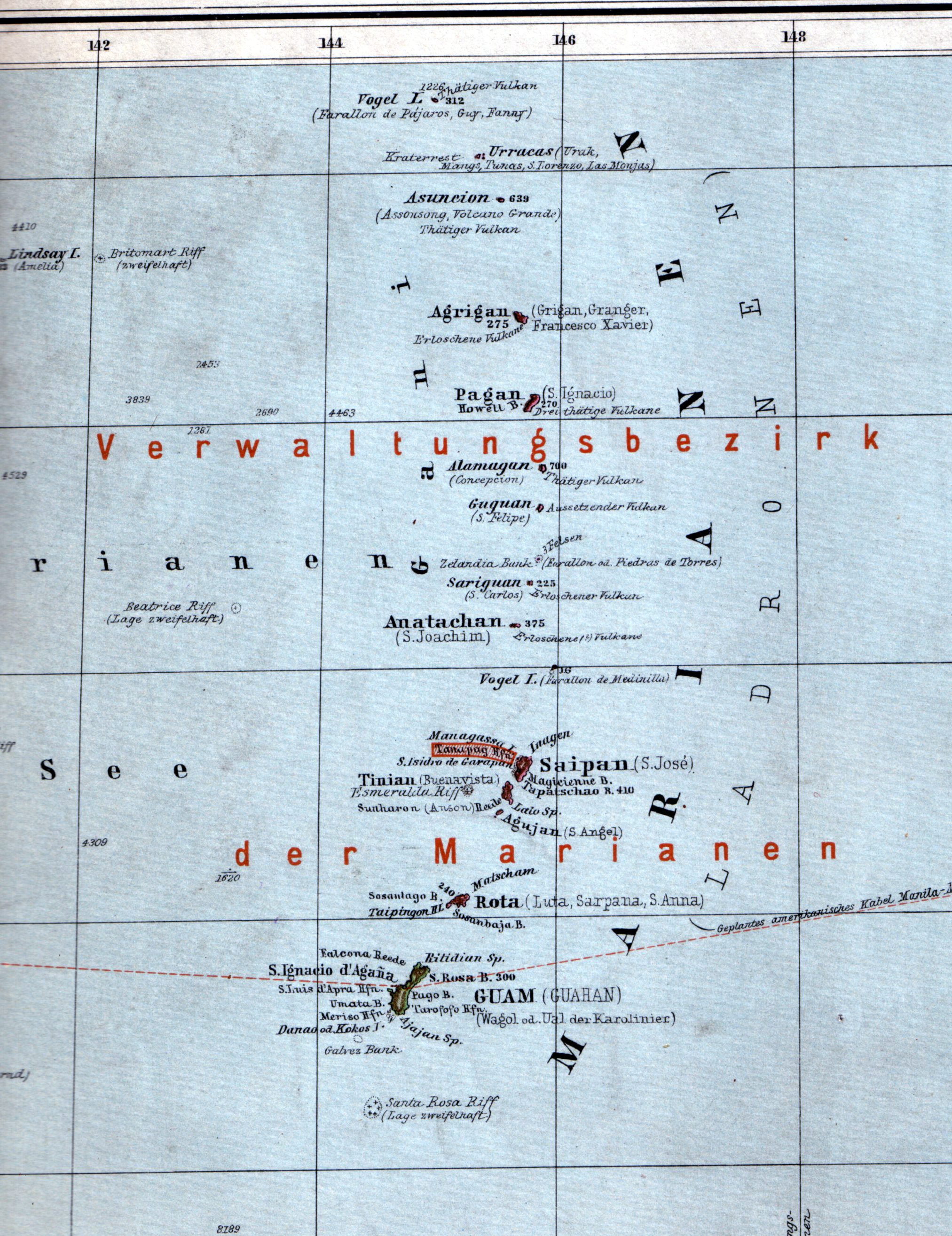
The Zealandia Bank (formerly Farallon de Torres or Piedras de Torres , chamorro : Papaungan ) consists of two rocks rising just above sea level and an undersea volcano . The bank belongs to the Northern Mariana Islands . The two rocks are about 1.5 km apart and are between the islands of Sarigan and Guguan . Due to its small size, Zealandia Bank is not shown on most maps. The island was given its current name in 1858, named after the British Bark Zealandia .
The volcano has two peaks, only one of which breaks the surface of the water. In 1956 there were reports of two rocks half a nautical mile apart. However, there are signs that the Zealandia Bank is expanding again: the island has been climbing since 1971, and a survey by NOAA in 2004 also discovered fumaroles , which indicate active volcanic activity.
Web links
- Zealandia Bank in the Global Volcanism Program of the Smithsonian Institution (English)
- Zealandia Bank. Pascal Horst Lehne and Christoph Gäbler: About the Marianas. Lehne-Verlag, Wohldorf, 1972
- Video
Individual evidence
Northern group: Agrigan | Alamagan | Anatahan | Asuncion | Farallon de Medinilla | Farallon de Pajaros | Guguan | Maug | Pagan | Sarigan | Zealandia Bank