Zielonka (Wierzbinek)
| Zielonka | ||
|---|---|---|
 Help on coat of arms |
|
|
| Basic data | ||
| State : | Poland | |
| Voivodeship : | Greater Poland | |
| Powiat : | Konin | |
| Geographic location : | 52 ° 27 ' N , 18 ° 34' E | |
| Residents : | ||
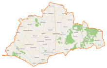
Zielonka is a district of the rural municipality of Wierzbinek in the Powiat Koniński in the Greater Poland Voivodeship . The Netze ( Polish Noteć ), the most important tributary of the Warta, flows south . The border with the Kuyavian-Pomeranian Voivodeship runs north . An abandoned evangelical cemetery from the middle of the 19th century is described in Zielonka. In the vicinity there is an archaeological site with early medieval traces of the settlement. In 2009 it had 70 inhabitants, including 34 women and 36 men.
history
German harvesters who had established the Dutch villages of Synogać, Deutsch-Gotzke, Przedworszyzna and Gałczyczki had settled in the forest of the landowner Karski. The place was officially founded by German colonists in 1784.
The place had different place names in the past. Today it belongs to the rural community of Wierzbinek. This is located near Sompolno in the Powiat Koniński of the Greater Poland Voivodeship in Poland. Originally the place or the colony was called Deutsch Gotsche or Deutsch Goczki. In the literature one also finds the name Klemmer Holland for it. On the Gilly map 1802-1803 for South Prussia, the place is shown as Königlich Gotzki. Later he was named Goczki Niemieckie.
The place should not be confused with the neighboring Polish Goczki (referred to as Adlich Goczki on the Gilly map). Today it is called Goczki Polskie. The place name was renamed after the first German colonist by the inhabitants of German descent: The settler family was called Grün, in Polish Zielon, from which the name Zielonka came about.
Individual evidence
- ↑ Agnieszka Lewandowska: PROGRAM OCHRONY ŚRODOWISKA DLA GMINY WIERZBINEK. June 2004, p. 15 , accessed April 28, 2019 (Polish).
- ↑ Bank Danych Lokalnych. Retrieved April 28, 2019 .
- ^ Albert Breyer: On the history of Sompolno and the surrounding area . In: Our home, folk series of publications to promote German homeland education and family tradition in Poland . Issue 4. Poznan 1938.
- ^ David Gilly: C3. Special map of South Prussia: with the greatest permission from the Royal Large Topographical Surveying Map, with the assistance of Director Langner . Simon Schropp et al. Comp., Berlin (1802-1803).
- ↑ Martin Kage: Folklore of the German settlements of the evangelical parish Sompolno . In: Dr. Alfred Lattermann (ed.): German scientific journal for Poland . Issue 36. Publishing House of the Historical Society for Posen, Posen 1939.

