List of architectural monuments in Elsterwerda
The list of architectural monuments in Elsterwerda gives an overview of the architectural monuments of the southern Brandenburg city of Elsterwerda , its districts and its district Kraupa . The basis is the publication of the state monument list as of December 31, 2019. It contains current as well as former or expired architectural monuments of the city.
The soil monuments are listed in the list of soil monuments in Elsterwerda .
Architectural monuments
Legend
The columns contain the following information:
- ID-No .: The number is assigned by the Brandenburg State Office for Monument Preservation . A link after the number leads to the entry about the monument in the monument database. The word Wikidata can also be found in this column ; the corresponding link leads to information on this monument at Wikidata.
- Location: the address of the monument and the geographical coordinates.
Link to a map view tool to set coordinates. In the map view, monuments without coordinates are shown with a red marker and can be placed on the map. Monuments without a picture are marked with a blue marker, monuments with a picture with a green marker. - Official designation: Designation in the official lists of the Brandenburg State Office for Monument Preservation. A link behind the name leads to the Wikipedia article about the monument.
- Description: the description of the monument
- Image: a picture of the monument and, if applicable, a link to further photos of the monument in the Wikimedia Commons media archive
Biehla
| ID no. | location | Official name | description | image |
|---|---|---|---|---|
|
09135780 |
Saathainer Strasse 2 ( location ) |
Transformation house | The transformer house , which has now been closed , is a plastered, two-storey brick building with a tent roof. | |
|
09135928 |
At the Nordbahnhof ( location ) |
Elsterwerda-Biehla station with reception building and platform roof, goods shed, water tower and carbide lamp bunker | The train station in today's Biehla district was built between 1873 and 1874 with the construction of the Upper Lusatian Railway from Kohlfurt via Biehla to Falkenberg . The builder Friedrich Jage , renowned in Elsterwerda, built this ensemble of buildings from Silesian clinker brickwork . The water tower, which belongs to the station complex and has since been decommissioned, was also built at this time. The station building has been privately owned since 2011 and is in great need of renovation. | |
|
09135387 |
Winterberg ( location ) |
Water tower | The Biehla water tower has a capacity of 90 m³ and is 140 m above sea level. NN visible from afar on the Winterberg. The building erected from 1913 to 1914, the facade of which was modeled on the Leipzig Völkerschlachtdenkmal , was intended to serve as a memorial and landmark of the site in addition to its technical purpose. The master builder of the district of Liebenwerda , Balsam, was responsible for this project . The structure, which is provided with a viewing platform, is in great need of renovation and is only sporadically accessible to the public. | |
|
09135505 |
Winterberg ( location ) |
Church with attached parish hall and surrounding green area | The Evangelical Christ Church is located a little below the water tower on the Biehlaer Winterberg. The foundation stone for the church was laid on July 3, 1955. The solemn consecration of the church took place on December 3, 1961. | |
|
09135377 |
Breite Strasse / Haidaer Strasse ( location ) |
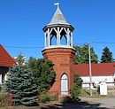
Bell tower | The 11.58 meter high Biehla bell tower, made of red brick, is located in the center of the district. Erected in 1862 by the master builder Dietrich, it has been a symbol of Biehla ever since. Inside there is a bell cast in Apolda in 1948 with the inscription: "Heinz Schurig sons in Apolda cast me in 1948 - Soli deo gloria". |
Elsterwerda
| ID no. | location | Official name | description | image |
|---|---|---|---|---|
|
09135652 |
Bahnhofstrasse 25 ( location ) |
Residential and commercial building | The residential and commercial building was built in the late classicism style in 1871/1890 . It is a plastered two-storey building with a gable roof. | |
|
09135379 |
( Location ) | Honor grove and war memorial with stele in the old cemetery | The war memorial created by the Elsterwerda sculptor Kranke in 1890 in the form of an obelisk to commemorate the inhabitants of Elsterwerda and Krauschütz who fell in the wars of 1866 and 1870/71 was originally in a central location on the memorial square, where it is surrounded by a green area and is popular The motif of numerous contemporary postcards was. After the Second World War, it was moved to the nearby former city cemetery in 1946, which was converted into a district memorial for the victims of fascism in 1982 and converted into a city park after the fall of the Wall.
There is a four meter high stele created by the Hohenleip artist Hans Eickworth, which is also a listed building. The stele is clad with four half-relief panels on the themes: The suffering of the anti-fascists and their liberation by Soviet soldiers , youth and mother - the reunion after liberation , the Jewish girl Anne Frank , as well as continued life and hope in the future . |
|
|
09135378 |
Berliner Strasse ( location ) |
Family funeral of the Nadler family in the old cemetery | The family grave of the Nadler family is located on the site of the former city cemetery, it was laid out in 1924. The seminary teacher Friedrich Nadler (1847–1924) and his wife Anna are buried on the eastern wall of the cemetery. His son, the renowned painter Hans Nadler (1879–1958) and his wife Elfriede are also buried there. | |
|
09135653 |
Berliner Strasse 2 ( location ) |
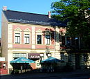
Residential and commercial building | The two-storey residential and commercial building with a gable roof was built in 1900 from bricks and red clinker bricks. At present, the Zeitlos café is located on the ground floor. | |
|
09135386 |
Elsterstrasse 3 ( location ) |
Preparation institute | The former preparation facility was built in 1898 by the Elsterwerda master builder Friedrich Jage . After the teachers' college was closed in 1926, the building was initially used by the upper secondary school in the Elsterschloss. After a labor camp was set up on the site in the 1930s , the building has been used almost entirely for vocational training since 1939 . | |
|
09135383 |
Elsterstrasse 20 ( location ) |
Post office | The building of the former Imperial Post Office was built in 1904 by the Elsterwerda builder Friedrich Jage on behalf of the Liebenwerda entrepreneur Carl Weiland . From 1928 the remote office was also located there. In 1999 the Elsterwerda post office was closed. After the house was used by an educational institution in the meantime, it has been empty for several years. | |
|
09135384 |
Furtbrückwiese ( location ) |
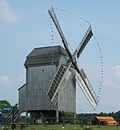
Post mill, in the adventure and miniature park | The original location of the Elsterwerda post mill was in Gruhno, 15 kilometers to the north . It was erected there in 1804. In 1866 the mill was relocated to Elsterwerda, where it was initially located near the train station, which was built a little later, and was in operation until 1958. After it had survived the Elsterwerda station fire in November 1997 due to fortunate circumstances, the approval for a renewed implementation was granted in the summer of 2000. Since 2004, the mill has been at its current location near the industrial park east, where it is in operation as a show system. Three years later, a 30,000 m² adventure and miniature park was built in its immediate vicinity. | |
|
09135376 |
Hauptstrasse / Rathausstrasse ( location ) |
Half-timbered house with upper arbor gallery | The two-storey historical half-timbered house with upper arbor gallery was built in 1801. At the end of the 1970s the building underwent extensive restoration work and in 1980 the small gallery "Hans Nadler" was opened in its rooms. A permanent exhibition on the upper floor pays tribute to the work of the painter Hans Nadler, who was born in Elsterwerda in 1879 . | |
|
09135374 |
Main street ( location ) |
Mail column | In the immediate vicinity of the St. Katharina Church there is a Saxon post mile column . The so-called distance column was originally erected in 1738 as one of the last in the electorate at the former Lucki Gate. During the term of office of Elsterwerda mayor Albert Wilde , the column, which was now lying around in Wallstrasse, was erected at its current location. | |
|
09135375 |
Hauptstrasse 8 ( location ) |
Residential building | The current building on the site is dated around 1900. It was first mentioned in a document, however, in 1708. From 1819, the pharmacy, which was privileged by the royal Prussians and existed as a municipal pharmacy until the 1990s, was located there. Most recently, the business premises were used by a tattoo studio . | |
|
09135371 |
Hauptstrasse 41 ( location ) |
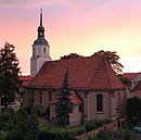
City parish church of St. Katharinen | The medieval brick building of the Protestant parish church of St. Katharinen is likely to be a building from the 15th century. The aisle church got its present shape mainly through renovation work in the 18th century. The interior of the church is determined by the Leipzig green color applied in 1831. The vestibule of the church was designed in 1922 and 1923 by the Elsterwerda-born artist Hans Nadler as a memorial hall for the fallen, which is characterized by a scraffito painting he created . The inventory of the church includes a baptismal font from 1520 to 1530, a pulpit altar from the 18th century and an organ from 1887. | |
|
09136047 |
Hauptstrasse 41 ( location ) |
Grave cross for the court gardener Seifert, in the churchyard | Court gardener Johann Carl Gottlieb Seifert (1769–1839) | |
|
09135807 |
Heinrich-Heine-Strasse 8 ( location ) |
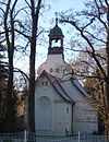
Catholic Church | The small Catholic church Sorrowful Mother is just north of the city center. It was built under pastor Ferdinand Schnettler to a design by the Liebenwerda architect Carl Jost and consecrated on September 28, 1913. The altar and ambo are made of sandstone. The church is equipped with a Rühle organ. As part of a renovation measure in 2007, the interior of the church was rebuilt, including the barrel vault with profiled timber cladding and the church being repainted. | |
|
09135036 |
Kirchstrasse 1 ( location ) |
Rectory | Plastered two-story building with a hipped roof. The rectory of the Protestant Church of St. Catherine was built in 1698. Renovation work took place around 1900. In 1994 it was extensively restored. | |
|
09135509 |
Lange Strasse 3 ( location ) |
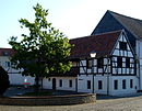
Agricultural bourgeois farm with house, small animal stable, cow and horse stable, transverse building and garden land | The ensemble of a typical agricultural bourgeois farm from the 19th century is located on today's market square of the city. It comprises a two-storey house with a gable roof and half-timbered house, a two-storey farm workers' house that closes off the courtyard and also has a gable-roof and half-timbered structure, and a single-storey stable building with a gable roof. | |
|
09135716 |
Rathausstrasse 10 ( location ) |
Residential building | Plastered two-story building with a gable roof. The windows date from 1870. | |
|
09135321 |
Schlossplatz 1 ( location ) |
Castle, office house, gardener's house and castle park | The three-winged Elsterschloss, which dates from the 18th century, was given its current appearance at the beginning of the 18th century under the then owner Baron Woldemar von Löwendal . In 1727 the Saxon Elector Augustus the Strong bought it and gave it to his daughter-in-law Maria Josepha of Austria , who underwent further renovations based on plans by court architect Pöppelmann , giving it the character of a hunting and pleasure palace. After the city of Elsterwerda fell to the Prussian Province of Saxony as a result of the Congress of Vienna, the Prussian Provincial School College commissioned the Ministry of Education to set up a teachers' seminar in the palace, which was opened in 1857. In 1926 followed in its place a secondary school and finally in 1938 a high school . It is now home to the Elsterschloss-Gymnasium , which with around 600 students is one of the most beautiful schools in Germany. The listed ensemble also includes an office building from 1781 with a crooked hip roof, the half-timbered building of the former court gardening center from 1783 and a palace park, which was also laid out in the 18th century. | |
|
09135380 |
Vineyards ( location ) |
Soviet honorary grave (part of the municipal cemetery on Kalkberg) | The Soviet cemetery of honor is located in the northern area of the Elsterwerda mountain cemetery. It was created in 1946 and 1947. 297 Soviet army personnel and 159 Soviet prisoners of war from the prisoner-of-war camp Stalag IV B near Mühlberg and the entire district of the former Liebenwerda district are buried there. The cemetery, which has a total of 110 grave sites, is characterized by two obelisks made of red sandstone and granite, which were given copper roofs in 1999. | |
|
09135823 |
Weststrasse ( location ) |
Water tower | The 32 meter high water tower in Weststrasse with a capacity of 250 m³ was built between 1905 and 1906 west of the city center. The building served the municipal water supply and the nearby train station. In 1948 the tower for the municipal water supply was decommissioned. The Deutsche Reichsbahn initially continued to use it. Since it was later no longer used for it, the water tower was to be demolished in the 1980s, which the monument protection could prevent. |
Kraupa
| ID no. | location | Official name | description | image |
|---|---|---|---|---|
|
09135508 |
Dorfstrasse ( location ) |
Bell tower | The bell tower of the Kraupa district was originally made of wood. In 1893 it was redesigned in stone. The consecration of bells took place on December 7, 1852. | |
|
09135647 |
Dorfstrasse 23 ( location ) |
Residential building | The single-storey rammed earth building with half-timbering and a saddle roof is located on the old village green of Kraupa. It was built in 1800. |
Krauschiitz
| ID no. | location | Official name | description | image |
|---|---|---|---|---|
|
09135825 |
Dresdener Strasse 34 ( location ) |
Department store | The former Krauschützer Kaufhalle was built in 1971 by the Elsterwerda company Menzel-Stahlbetonteile GmbH. |
Beyond the municipal boundaries
| ID no. | location | Official name | description | image |
|---|---|---|---|---|
|
09135504 |
Kotschka ( location ) |
Grödel-Elsterwerda raft canal between Elsterwerda and Prösen | In the southwest of the city is the Grödel-Elsterwerda raft canal, which has been connecting the Pulsnitz , which has been flowing along there, with a basin on the Elbe in Grödel in Saxony ( beginning in Grödel , end of Elsterwerda ) since the 18th century . The original purpose of the canal, currently used primarily for recreational purposes, was to meet the high demand for wood in the Dresden / Meißen area in the forests in the northern parts of the country. Later, until shipping was discontinued in 1942, it was primarily used as a transport route for the Gröditz ironworks . Boats pulled by bombers were used for transport on the canal . From the 1960s until the fall of the Wall it was used as an irrigation canal. The 21.4 kilometer long raft channel has had the status of an architectural monument since 1978 . In the Elsterwerda section, the remains of the local lock are still preserved and the former towpath can be seen. |
Former or abandoned architectural / cultural monuments
| ID no. | location | Official name | description | image |
|---|---|---|---|---|
|
|
Elsterwerda Hauptstrasse 34 ( location ) |
Residential building | The building of the former Selkmann bakery was once located in the immediate vicinity of the market square. Erected around 1800, it was one of the oldest surviving houses in downtown Elsterwerda. As early as the 1990s, the owners made efforts to have the house, which had been vacant since the fall of the Wall, replaced by a new building. Between 2000 and 2003, however, it was placed under monument protection, which initially prevented it from being demolished in 2012. |
Web links
- List of monuments of the state of Brandenburg: Elbe-Elster district (PDF) Brandenburg State Office for Monument Preservation and State Archaeological Museum
Individual evidence
- ↑ a b c d e f g h i j k l m n o p database of the Brandenburg State Office for the Preservation of Monuments and the State Archaeological Museum ( Memento of the original dated December 9, 2017 in the Internet Archive ) Info: The archive link was inserted automatically and not yet checked . Please check the original and archive link according to the instructions and then remove this notice. , accessed September 5, 2016.
- ↑ a b c Manfred Reuschel: The water supply of Biehla and Elsterwerda in past centuries. In: Home calendar for the old district of Bad Liebenwerda, the Mückenberger Ländchen, outskirts on Schraden and Uebigau-Falkenberg. No. 53. Ed .: Arbeitsgemeinschaft für Heimatkunde e. V. Bad Liebenwerda. Gräser Verlag, Großenhain 2000, ISBN 3-932913-16-7 , pp. 248-258.
- ^ Frank Claus: Oppelhain, Uebigau and Elsterwerda-Biehla train stations auctioned. In: Lausitzer Rundschau. July 12, 2012.
- ↑ Elsterwerda City Administration (ed.): Biehla-A district with a historical and industrial background . ( Information sheet online as PDF file ).
- ↑ List of monuments of the state of Brandenburg: Elbe-Elster district (PDF) Brandenburg State Office for Monument Preservation and State Archaeological Museum
- ^ A b Felix Hoffmann: From Elsterwerdas church history in 750 years Elsterwerda 1211–1961 . Ed .: Festival committee at the Elsterwerda City Council. Elsterwerda 1961, p. 11 to 15 (Festschrift of the city of Elsterwerda on the occasion of its 750th anniversary).
- ↑ Elsterwerda City Administration (ed.): "Biehlaer Glockenturm - the center of the Biehla district" . 2007 ( information sheet online as PDF file ).
- ↑ Werner Galle, Werner Horn: Elsterwerdas places in the course of time . In: Arbeitsgemeinschaft für Heimatkunde eV Bad Liebenwerda (Hrsg.): Heimatkalender - For the country between Elbe and Elster 2004/2005 . No. 56 . Gräser Verlag, Großenhain 2004, ISBN 3-932913-47-7 , p. 99-116 .
- ↑ Regina Scheer: Dealing with the monuments. A research in Brandenburg. Ed .: Brandenburg State Center for Political Education and Ministry for Science, Research and Culture of the State of Brandenburg, Potsdam 2003, p. 53. ( Archived copy ( memento of the original dated December 2, 2007 in the Internet Archive ) Info: The archive link was inserted automatically and not yet checked. Please check the original and archive link according to the instructions and then remove this note. PDF).
- ^ Gerhard Graf: Development of the vocational school in Elsterwerda . Edited by Festival committee at the Elsterwerda City Council. In: 750 years Elsterwerda 1211–1961 . Elsterwerda 1961, p. 69, 70 (Festschrift of the city of Elsterwerda on the occasion of its 750th anniversary).
- ↑ Flyer: Imperial Post Office. A house with tradition. ( online as a PDF file )
- ↑ Werner Horn: From the life of the last Elsterwerda post mill . In: Arbeitsgemeinschaft für Heimatkunde e. V. Bad Liebenwerda (Ed.): Local calendar for the country between Elbe and Elster 2004/2005 . 2004, p. 275-284 .
- ↑ Website of the Elsterwerda Adventure and Miniature Park ( Memento of the original from July 14, 2014 in the Internet Archive ) Info: The archive link has been inserted automatically and has not yet been checked. Please check the original and archive link according to the instructions and then remove this notice. , accessed June 10, 2014.
- ↑ Elsterwerda City Administration (ed.): The Small Gallery "Hans Nadler" . 2004 (information sheet).
- ↑ Margarete Noack: Elsterwerda - When the chimneys were still smoking: Photo documents from the years 1949–1989 . Verlag für Kulturgeschichte und Kunst, 2004, ISBN 3-910143-14-8 , p. 99 .
- ↑ Werner Galle: 260 years of the post column in Elsterwerda. In: Arbeitsgemeinschaft für Heimatkunde e. V. Bad Liebenwerda (Ed.): Local calendar for the old district of Bad Liebenwerda, the Mückenberger Ländchen, outskirts on Schraden and Uebigau-Falkenberg – 1998 . Großenhain 1998, p. 164-168 .
- ↑ Flyer: Post mileage column ( online as PDF file )
- ↑ Information board on the building
- ^ Pretzel, Andreas: "Hans Nadler" . Ed .: Cultural Office of the Elbe-Elster District. 1999, ISBN 3-00-004516-3 , p. 138 .
- ^ A b c Georg Dehio , Gerhard Vinken: Handbook of German Art Monuments, Brandenburg . Deutscher Kunstverlag , 2000, ISBN 3-422-03054-9 , p. 265-267 .
- ↑ Cultural Office of the Elbe-Elster district, Bad Liebenwerda district museum, Sparkasse Elbe-Elster (ed.): Orgellandschaft Elbe-Elster . Herzberg / Elster 2005, p. 14-15 .
- ↑ Article: A piece of jewelery from the church in the Catholic weekly newspaper Day of the Lord
- ^ M. Karl Fitzkow , Fritz Stoy: Elsterwerda at the turn of the 20th century . In: Home calendar for the Bad Liebenwerda district . tape 1969/70 , pp. 54 .
- ^ Horst Paulick: The Elster Castle in Elsterwerda as an educational institution . In: Arbeitsgemeinschaft für Heimatkunde e. V. Bad Liebenwerda (Hrsg.): Home calendar - For the country between the Elbe and Elster . No. 53 . Gräser Verlag, Bad Liebenwerda 2000, p. 140-153 .
- ↑ Stefanie Endlich, Nora Goldenbogen, Beatrix Herlemann , Monika Kahl, Regina Scheer: Memorials for the Victims of National Socialism II , Federal Agency for Civic Education , Bonn, Autumn 2000, pp. 260/261.
- ↑ Weeds and withered wreaths. In: Lausitzer Rundschau. August 28, 2007.
- ↑ Elsterwerda City Administration (ed.): "600 Years of Kraupa" . 2007 ( information sheet online as PDF file ).
- ↑ Luise Grundmann, Dietrich Hanspach (author): Der Schraden. A regional study in the Elsterwerda, Lauchhammer, Hirschfeld and Ortrand area . Ed .: Institute for Regional Geography Leipzig and the Saxon Academy of Sciences in Leipzig. Böhlau Verlag, Cologne / Weimar / Vienna 2005, ISBN 3-412-10900-2 , p. 137 .
- ^ Siegfried Galle: The bakery trade in Elsterwerda . In: Historical archive of the city of Elsterwerda (Ed.): Elsterwerdaer Geschichtsblätter . No. 3 , 2010, p. 5 .
- ^ Frank Claus: Demolition excavator or further ruins. In: Lausitzer Rundschau . Regional section Elsterwerda, March 27, 2010.


