List of protected areas in the Lake Constance district
The list of protected areas in the Lake District includes the statistics of all protected areas - nature and landscape protection areas , FFH and SPA areas , Bann and early forests and natural monuments - in Baden-Württemberg Bodenseekreis in Germany .
Geographical location
The approximately 665 square kilometers large Lake Constance district extends along the northern shore of Lake Constance with the adjacent Upper Swabian hill country , which merges into the western Allgäu hill country in the east . In the north it borders on the districts of Sigmaringen and Ravensburg , in the east on the Bavarian district of Lindau , in the south Lake Constance forms the natural border with Switzerland (cantons Thurgau and St. Gallen ) and Austria ( Vorarlberg ), in the west it borders the District of Constance .
In the Lake Constance district (status: October 19, 2011) 33 nature reserves with a total area of 1,217.26 hectares (ha) are designated; this corresponds to a share of 1.83 percent of the area of the circle. In addition, there are 27 designated landscape protection areas (9,114.64 ha; 13.71%), eleven FFH areas (3,900.78 ha; 5.87%), three bird protection areas (882.98 ha), and a protected forest (35.50 ha) , two protected forests (137.80 ha) as well as a total of 175 natural monuments (41.51 ha) and 4,508 biotopes .
Explanation
The following headings and abbreviations are used in the table headings of the lists:
- SG-No .: Protected area number according to the State Institute for the Environment, Measurements and Nature Conservation Baden-Württemberg (LUBW)
- Name: official name of the protected area according to the LUBW
- Location: City, municipality or district that is closest to the respective protected area
- Size: Area in hectares (1 hectare = 10,000 m²) of the respective protected area, rounded to one decimal place
- Height: is the geographical altitude relative to mean sea level at
- TK: indicates the number / s of the respective topographic map in which the protected area is listed
- NR: indicates the natural area in which the protected area is located; "AD" = Adelegg ; "BB" = Lake Constance basin ; "HE" = Hegau ; "LI" = Linzgau ; "OH" = Upper Swabian hill country ; "WA" = West Allgäu hill country
- KO: Indication of the geographical coordinates of the respective protected area; linked, opens card
- Registration: Date of the respective registration / inclusion in the corresponding protected area directory
- Comment / s: Descriptions etc. of the respective protected area
- Image: Photo of the respective protected area
All data given as of October 19, 2011
Protected areas
Nature reserves
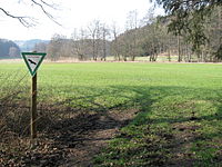
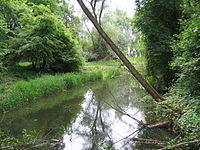
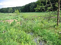
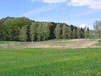
A nature reserve (NSG) is a strictly protected area. In Germany, nature reserves are defined by or on the basis of laws. Colloquially, the term nature reserve also describes all protected areas in nature and landscape protection . Areas are often designated as nature reserves which are important for the preservation of the flora and fauna, often also for scenic and geographic features. The aim is to place plant and animal species under protection in their area of distribution. Areas are also designated as nature reserves if they are considered worthy of protection for scientific or natural history reasons, because of their uniqueness or special beauty. These are often biotopes such as moorland , heathland , mountainous landscapes or forests . In nature reserves, agricultural use, leaving the publicly marked trails and lighting fires are mostly prohibited.
In the Lake Constance district there are 33 nature reserves with a total area of around 1,217 hectares ; this corresponds to a share of 1.83 percent of the area of the circle.
The following, sortable list contains all nature reserves in the Lake Constance district; Names and numbers correspond to the official designations, the protected area number results from the administrative district (4 = Tübingen administrative district ) and a consecutive number within the district.
| SG no. | Surname | Places | size | height | TK | NO | KO | Capture | Remarks | image |
|---|---|---|---|---|---|---|---|---|---|---|
| 4,057 | Aachtobel |
Frickingen Owingen Ueberlingen |
72.0 | 520-607 | 8121 | BB |
|
March 24, 1939 | one of the oldest nature reserves in Germany; is of the Linzer Aach flows through | |
| 4,093 | Altweiherwiese | Oberteuringen | 78.3 | 450 | 8222 8223 |
OH |
|
11/16/1981 | in earlier literature sources also referred to as " Teuringer Moos " or " Altweihermoor " | |
| 4,282 | Bad |
Kressbronn Neukirch Tettnang |
296.3 FN : 234.8 RV : 61.5 |
395-496 | 8323 8324 8423 |
BB WA |
|
12/16/1997 |
Part of the area in the Ravensburg district ; third largest tributary of Lake Constance |
|
| 4,071 | Auweiher | Neukirch | 7.3 FN : 3.1 RV : 4.2 |
530 | 8324 | WA |
|
December 21, 1973 |
Part of the area in the Ravensburg district ; The Schwarzach flows through NSG to the west |
|
| 4,315 | Berger pond | Kressbronn - mountain | 19.0 | 450 | 8323 | WA |
|
05/18/2007 | Lime moor complex in the valley of a former pond | |
| 4,206 | Birch pond | Tettnang | 12.9 | 510 | 8323 | WA |
|
07/20/1992 | Kleinseggenried , which offers a habitat for numerous rare and protected animal and plant species | |
| 4,219 | Buchbach |
Neukirch Tettnang |
7.1 | 490 | 8323 | WA |
|
03/20/1993 | Ecosystem with near-natural Kreuzweiherbach , pipe grass and wet meadows , ponds and hill spring moor | |
| 4,259 | Ebersberger Weiher | Neukirch | 25.8 FN : 23.7 RV : 2.1 |
550 | 8324 | WA |
|
04/26/1995 |
Part of the area in the Ravensburg district ; richly structured ecosystem consisting of a pond , two silted up ponds with wet meadow flora, litter meadows and pipe grass litter meadows |
|
| 4,020 | Eriskircher Ried |
Eriskirch Friedrichshafen |
552.0 | 395-400 | 8322 8323 |
BB |
|
07/08/1939 | largest nature reserve on the northern shore of Lake Constance , between the Rotach and the Schussen estuaries | |
| 4.210 | Chamois pond | Neukirch | 11.6 | 560 | 8324 | WA |
|
10/01/1992 | former pond, which has developed into a flat moor with litter meadows | |
| 4.114 | Hepbacher-Leimbacher Ried |
Friedrichshafen Markdorf Oberteuringen |
46.5 | 440 | 8222 8322 |
BB |
|
07/12/1983 | Remnants of a low moor complex , headwaters of the Brunnisach ; adjoining landscape protection area | |
| 4,238 | Hirrensee | Tettnang | 16.3 | 510 | 8323 | WA |
|
02/20/1994 | richly structured ecosystem with flat moor , pipe grass litter and orchards | |
| 4,054 | Hödinger Tobel |
Sipplingen Überlingen |
27.7 | 530 | 8220 | BB |
|
10/21/1938 | Erosion tuber in the Überlingen molasse area ; one of the oldest nature reserves in Germany. | |
| 4,247 | Hüttensee | Neukirch | 17.4 | 550 | 8324 | WA |
|
10/20/1994 | Naturally formed lake with a wide silt belt and floating leaf communities, low-nutrient flat and hill spring moor areas | |
| 4.224 | Hut meadows | Neukirch | 7.8 | 540 | 8324 | WA |
|
07/30/1993 | richly structured ecosystem with nutrient-poor hillside spring moors, wet and wet meadows | |
| 4.211 | Igelsee | Neukirch | 16.9 | 545 | 8324 | WA |
|
10/01/1992 | Flat and hillside spring moor | |
| 4.119 | Hunter pond | Neukirch | 6.2 | 560 | 8324 | WA |
|
05/15/1990 | Pond, with wide, floristically valuable silting zones, litter meadows and forest fringes | |
| 4.154 | Katharinenfelsen | Überlingen | 3.9 | 420 | 8220 | BB |
|
02/16/1989 | unique landscape structure with rock formations and a glacier pot | |
| 4,268 | Knellesberger moss |
Meckenbeuren Tettnang |
39.4 FN : 32.0 RV : 7.4 |
519-541 | 8223 8323 |
WA |
|
08/28/1996 |
Part of the area in the Ravensburg district ; wide meadow valley with almost continuously meandering Schwarzach |
|
| 4.152 | Köstenerberg | Sipplingen | 15.5 | 400-530 | 8120 | BB |
|
02/16/1989 | White sedge-beech forest and white clover-pine forest, semi-arid lawns and orchards with extremely diverse and natural vegetation | |
| 4,070 | Kreuzweiher-Langensee | Neukirch | 74.9 | 540 | 8324 | WA |
|
December 21, 1973 | richly structured ecosystem , from the two ponds cross Weiher and Langensee consisting | |
| 4.102 | Lipbach estuary |
Friedrichshafen Immenstaad |
15.7 | 396 | 8322 | BB |
|
12/17/1982 | Woody stock as well as the shore zone of Lake Constance and the offshore shallow water zone | |
| 4,227 | Lipbach Valley |
Friedrichshafen Immenstaad |
29.0 | 430 | 8322 | BB |
|
08/25/1993 | largely natural brook floodplain of the mostly freely meandering Lipbach with subsequent swamp forest , forest and wood fringes as well as clay pit waters (" Heger Weiher ") | |
| 4,232 | Loderhof pond | Tettnang | 10.4 | 500 | 8323 | WA |
|
11/24/1993 | Ecosystem of pipes Grass Trust - wet and wet meadows , grassland, individual stands of trees and wood structures, damp forest clearing , slope fen area and silting fen | |
| 4,196 | Markdorfer Eisweiher | Markdorf | 12.3 | 430 | 8222 | BB |
|
02/11/1992 | Remnants of a low moor complex as a habitat for rare animal and plant species, some of which are threatened with extinction | |
| 4,220 | Matzenhauser Mahlweiher | Tettnang | 9.2 | 500 | 8323 | WA |
|
04/01/1993 | richly structured ecosystem , consisting of hillside spring moor , pipe grass litter , wet meadows and forested terminal moraine | |
| 4,310 | Schachried |
Kressbronn Tettnang |
11.0 | 480 | 8323 | WA |
|
02/15/2005 | Fen areas of community importance | |
| 4,316 | Schönmoos | Kressbronn | 10.0 | 460 | 8323 | WA |
|
05/18/2007 | Flat bog complex with different biotope types and species compositions | |
| 4,208 | Black trench | Salem | 27.9 | 445 | 8221 | BB |
|
07/24/1992 | Wet meadows as breeding, feeding and resting places for meadow breeders and migrating bird species | |
| 4,059 | Seefeld Aach estuary | Uhldingen-Mühlhofen | 54.7 | 398 | 8221 | BB |
|
05/11/1940 | Unique area where it flows into Lake Constance with extensive reed areas , a shallow water zone, the tall herbaceous meadow, the reed areas and the oxbow lakes of the Linz Aach | |
| 4.153 | Sipplinger triangle | Sipplingen | 15.0 | 400-528 | 8220 | BB |
|
02/16/1989 | extremely natural and diverse vegetation units | |
| 4,055 | Spetzgarter Tobel | Überlingen | 15.0 | 400-528 | 8220 | BB |
|
October 29, 1938 | erosion gorge ( ravine ) cut up to 65 meters deep by the Killbach in the " Sipplinger Molasse landscape " | |
| 4.025 | Wasenmoos | Tettnang | 26.7 | 465 | 8223 8323 |
BB OH |
|
October 18, 1939 | Flat and transitional bog on a würmeiszeitlichen Talwasserscheide, mostly abgetorft with birch -Bruchwald |
Landscape protection areas
In Germany, the landscape protection area (LSG) is one of the options for area-related nature protection provided by the Federal Nature Conservation Act (BNatSchG). The federal states determine which areas can be designated as landscape protection areas . They also determine the form in which the landscape protection areas are marked. Paragraph 26 of the BNatSchG stipulates that landscape protection areas should serve the preservation and development of nature, impairments of the natural balance should be eliminated and the performance and functionality restored. This happens because of the diversity and uniqueness of the landscape, its cultural and historical importance or its special importance for recreation.
In the Lake Constance district, there are 27 protected landscape areas with a total area of 9,114.64 hectares; this corresponds to a share of 13.71 percent of the area of the circle.
The following, sortable list contains all landscape protection areas in the Lake Constance district; Names and numbers correspond to the official designations, the protected area number results from the administrative district (4 = Tübingen administrative district ) and a consecutive number within the district.
| SG no. | Surname | Places | size | height | TK | NO | KO | Capture | Remarks | image |
|---|---|---|---|---|---|---|---|---|---|---|
| 4.35.003 | Altweiherwiese and Taldorfer Bach | Oberteuringen | 76.0 | 450-498 | 8222 | OH |
|
03/31/1952 | geologically significant meltwater channel of the Würm late glacial; Valley section of the Ur-Argen | |
| 4.35.002 | Argenaue Reutenen | Langenargen | 11.0 | 400 | 8423 | BB |
|
07/31/1985 | prehistoric river bed in the area of the Argenaue with groups of trees and litter meadows | |
| 4.35.031 | Shores of Lake Constance | Daisendorf , Hagnau , Immenstaad , Meersburg , Salem , Sipplingen , Stetten , Überlingen , Uhldingen-Mühlhofen | 3,765.0 | 8220 8221 8321 8322 |
BB LI |
09/15/1982 | 19 sub-areas; varied landscape of the shores of Lake Constance of supraregional importance and with high recreational value | |||
| 4.35.028 | Drumlin Biblis | Überlingen | 15.0 | 614 | 8120 | LI |
|
07/18/1938 | impressive drumlin created by the ice age | |
| 4.35.029 | Drumlin "Im Hasenbühl" and "Gegez" | Owingen | 18.0 | 530-576 | 8120 | LI |
|
07/18/1938 | impressive hilly landscape created by the ice age in the younger, hilly meltwater landscape | |
| 4.35.038 | Ice rim forms between Rebholz and Knellesberg | Meckenbeuren | 279.0 | 448-529 | 8223 |
|
07/19/1996 | Worm Ice Age ice rim shapes with lateral moraines, terminal moraines and outflow into the lowlands | ||
| 4.35.040 | Ice Age edges of the Argental with Argenaue |
Kressbronn Langenargen Neukirch Tettnang |
1,621.0 | 400-575 | 8323 8324 8423 |
BB |
|
12/16/1997 | geological unit of the Argen glacial valley . | |
| 4.35.018 | End moraine cone Ebersberg with Mahlweiher | Neukirch | 5.0 | 583 | 8324 | WA |
|
09/10/1954 | slender circular cone of the standstill position of the Rhine glacier | |
| 4.35.017 | Terminal moraine "Höhe 585.1" between Gunzenweiler and Litzelmannshof | Neukirch | 21.0 | 550-585 | 8324 | WA |
|
09/10/1954 | slender circular cone of the standstill position of the Rhine glacier with scenic beauty and uniqueness | |
| 4.35.008 | Terminal moraine wall and moor north of Rappertsweiler | Tettnang | 37.0 | 500-551 | 8323 8324 |
WA |
|
09/10/1954 | one of Endmoränenwällen framed, reed overgrown fen | |
| 4.35.041 | Haldenberg | Friedrichshafen | 105.0 | 450-479 | 8222 8223 8322 8323 |
BB |
|
11/26/2001 | More distinctive, more visible from afar, the landscape characterizes Drumlin with the Haldenberg chapel, which is protected as a cultural monument, meadows, orchards, wooded structures, fields, orchards | |
| 4.35.027 | Heiligenberg |
Frickingen Heiligenberg |
202.0 | 756 | 8121 | LI |
|
02/18/1938 | Ridge from the 'Alten Wachberg' over the 'Schlossberg' to the 'Nagelstein' with molasses spur and cover from the crack ice age | |
| 4.35.033 | Hepbacher-Leimbacher Ried |
Friedrichshafen Markdorf Oberteuringen |
66.9 | 437 | 8222 | LI |
|
07/12/1983 | two partial areas; the LSG serves to avoid negative influences on the NSG of the same name |
|
| 4.35.032 | Highest | Deggenhausertal | 7.0 | 801 | 8122 | LI |
|
04/10/1938 | a mountain range defining the landscape with an excellent view | |
| 4.35.023 | Height 493.8 south of Tettnang near Schäferhof | Tettnang | 7.1 | 494 | 8323 | WA |
|
12/24/1954 | Meltwater summit of geological significance from the period of Late Glacial of the Rhine glacier is the only lonely hill on the table like a flat terrace of the gravel surface Tettnang | |
|
4.35.039 and 4.36.073 |
Knellesberger moss |
Meckenbeuren Tettnang |
22.0 FN : 14.4 RV : 7.6 |
519-541 | 8223 | WA |
|
08/28/1996 |
Part of the area in the Ravensburg district ; two partial areas of supplementary room and buffer zone for the NSG of the same name |
|
| 4.35.037 | Lipbach Valley |
Friedrichshafen Immenstaad |
25.0 | 430 | 8322 | BB |
|
08/25/1993 | largely natural stream floodplain of the mostly freely meandering Lipbach with subsequent swamp forest, forest and wood fringes as well as clay pit waters | |
| 4.35.036 | Lippertsreuter area |
Salem Ueberlingen |
527.0 | 470-559 | 8121 | LI |
|
December 23, 1993 | Landscape formed by the Würm Glacier and its meltwater with ice edge layers, erosion edges, delightful ravines and natural streams and rivers | |
| 4.35.035 | Markdorfer Eisweiher | Markdorf | 16.3 | 428-435 | 8222 | LI |
|
02/11/1992 | the edge areas of the NSG of the same name serve to avoid negative influences on the NSG | |
| 4.35.030 | Salem kill pond | Salem | 550.0 | 8221 | LI |
|
09/17/1951 | Salem castle district with Leopoldshöhe, Scheuerbuch, Krankenhalde, Wacholderbühl, Kirchberghölzle, Forsterhof, Spitznagelhof, Markgräfinweiher, Martinsweiher and the Killenweiher | ||
| 4.35.022 | Sand and dredging pits north and west of the beer cellar | Langenargen | 15.0 | 8323 | BB |
|
12/24/1954 | Landscape with geological outcrops , also of economic importance for reasons of tourism | ||
| 4.35.034 | Lake district and hill country south of the Argen and Nonnenbachtal |
Kressbronn Tettnang |
968.0 | 8323 8324 |
BB WA |
|
06/19/1986 | two partial areas; Hilltop landscape with embedded lakes, stream valleys and wooded hills in their scenic diversity and natural biotopes that still exist in large numbers |
||
| 4.35.026 | Late Worm Ice Age terraces between Burnau, Prestenberg, Vorderreute, Buch and Krumbach | Tettnang | 23.0 | 527 | OH |
|
01/25/1963 | Late- worm-age terraces of significant river history | ||
| 4.35.005 | Steep edge and gravel field of the Argental south of the digester mill | Kressbronn | 13.0 | 410 | BB |
|
09/10/1954 | Late glacial Arg terrace , enclosed by the LSG Ice Age Rims of the Argental with Argenaue | ||
| 4.35.021 | Tettnang Forest with Hochwacht, Krüntenbühl, Reichenbühl, Argenhardter Kopf, Schoos and the steep edge of the Argental on the Schwandenbogen | Tettnang | 701.0 | 430-541 |
BB OH |
|
09/19/1954 | Scenic points of geological importance for the history of the late glacial such as the ice edge layers of the middle and upper Tettnang level | ||
| 4.35.001 | Württemberg shore of Lake Constance |
Friedrichshafen Kressbronn Langenargen |
35.3 | BB |
|
09/13/1940 | three partial areas; Natural beach and beach forest with black poplar and oak trees | |||
| 4.35.042 | Württemberg shore of Lake Constance - new version of the Friedrichhafen-West section | Friedrichshafen | 114.0 | BB |
|
02/26/2004 |
FFH areas
The Fauna-Flora-Habitat Directive , or Habitat Directive for short, is a nature conservation directive of the European Union that was adopted in 1992 . Together with the Birds Directive , it essentially serves to implement the Bern Convention ; one of its main tools is a coherent network of protected areas called Natura 2000 .
The correct German name for the Habitats Directive is Council Directive 92/43 / EEC of May 21, 1992 on the conservation of natural habitats and wild animals and plants . In Germany, however, the term FFH directive is used almost exclusively, which is derived from fauna (= animals), flora (= plants) and habitat (= habitat).
Eleven FFH areas with a total area of 3,900.78 hectares are designated in the Lake Constance district; this corresponds to a share of 5.87 percent of the area of the circle.
The following, sortable list contains all FFH areas in the Lake Constance district. Names and numbers correspond to the official designations.
| SG no. | Surname | Places | size | height | TK | NO | KO | Capture | Remarks | image |
|---|---|---|---|---|---|---|---|---|---|---|
| DE8323342 | Argen and wetlands south of Langnau |
Kressbronn Langenargen Neukirch Tettnang |
508.5 FN : 416.4 RV : 91.1 |
394-564 | 8323 8324 8423 |
BB WA |
|
01/01/2005 |
Part of the area in the Ravensburg district ; near-natural, alpine-influenced river landscape of the Argen with adjoining or nearby near-natural lakes and low-moor complexes |
|
| DE8221341 | Lake Constance hinterland near Überlingen |
Frickingen Owingen , Salem Ueberlingen Uhldingen-Mühlhofen |
316.9 | 411-674 | 8120 8121 8221 |
BB HE OH |
|
01/01/2005 | Landscape shaped by the ice age with deeply cut ravines, natural flowing waters, meadows and ponds | |
| DE8221342 | Lake Constance hinterland between Salem and Markdorf | Bermatingen , Daisendorf , Friedrichshafen , Immenstaad , Markdorf , Meersburg , Oberteuringen , Salem , Uhldingen-Mühlhofen | 404.6 | 401-563 | 8221 8222 8322 |
BB LI |
|
01/01/2005 | Ponds, moors and forests in the hinterland of Lake Constance | |
| DE8322341 | Shores of Lake Constance west of Friedrichshafen |
Friedrichshafen Hagnau Immenstaad Meersburg , Stetten |
458.8 FN : 35.2 |
388-424 | 8321 8322 |
BB |
|
01/01/2005 | Shallow water and bank zone of Lake Constance | |
| DE8423341 | Lake Constance landscape east of Friedrichshafen |
Eriskirch Friedrichshafen Kressbronn Langenargen |
1363.4 FN : 808.9 |
391-463 | 8322 8323 8423 |
BB |
|
01/01/2005 | Largest shallow water zone on the north bank of the Obersee with river mouths, reed areas, whistle grass meadows and forests | |
| DE8222341 | Deggenhauser Valley |
Deggenhausertal Heiligenberg Markdorf Salem |
811.9 FN : 806.1 SIG : 5.8 |
472-814 | 8121 8122 8222 |
OH LI |
|
01/01/2005 |
Part of the area in the district of Sigmaringen ; The Deggenhauser Aach valley with side valleys, valley slopes, edge heights and a diverse range of uses |
|
| DE8324341 | Moors and ponds around Neukirch |
Neukirch Tettnang |
240.0 FN : 201.7 RV : 38.3 |
478-580 | 8224 8323 8324 |
BB WA |
|
01/01/2005 |
Part of the area in the Ravensburg district ; Moors, ponds and lakes in the depressions of the Jungmöränen landscape around Neukirch , partly in the open country, partly in the forest |
|
| DE8222342 | Rotachtal Lake Constance |
Deggenhausertal Friedrichshafen Oberteuringen |
466.2 FN : 173.0 RV : 293.2 |
|
01/01/2005 |
Part of the area in the Ravensburg district ; Valley of the Rotach to the confluence with Lake Constance with deeply cut ravines in the upper reaches, as well as low moorland, Altweiherwiese and clay pit |
||||
| DE8323341 | Schussenbecken and Schmalegger Tobel |
Eriskirch Friedrichshafen Meckenbeuren Tettnang |
904.8 FN : 204.3 RV : 700.5 |
- |
BB OH |
|
01/01/2005 |
Part of the area in the Ravensburg district ; contiguous running water system with ditches, near-natural and developed streams |
||
| DE8220342 | Überlinger See and Lake Constance landscape |
Meersburg Sipplingen Ueberlingen Uhldingen-Mühlhofen |
3768.7 FN : 410.4 KN : 264.4 |
- |
BB HE |
|
01/01/2005 |
Part of the area in the district of Constance ; Überlinger See and Überlinger steep bank landscape, which stretches in a striking way from the shallow water zone of Lake Constance to the heights above the lake |
||
| DE8324343 | Lower Argen and side valleys | Neukirch | 982.8 FN : 3.1 RV : 978.9 |
496-737 | 8224/25 8226 8324/26 |
AD WA |
|
01/01/2005 |
Part of the area in the Ravensburg district ; Near-natural, alpine-influenced river landscape with high natural dynamics and deeply cut side valleys. |
Bird sanctuaries
A European bird sanctuary or Special Protection Area (SPA) is a protected area, the basis of which was laid in 1979 in Article 4 (1) of the Birds Directive of the European Union (EU). These areas are part of the Europe-wide Natura 2000 biotope network . The concept of bird sanctuaries across Europe serves in particular to protect migratory birds , which rely on rest stops on their migratory routes in order to look for food and to be able to rest. The European bird sanctuaries are subject to the protection criteria of the Fauna-Flora-Habitat Directive. As the implementation by the EU member states was in some cases very slow, nature conservation associations named so-called Important Bird Areas , which they proposed for designation as European bird sanctuaries.
In the Lake Constance district there are three European bird sanctuaries with a total area of 882.98 hectares; this corresponds to a share of 1.33 percent of the area of the circle.
The following, sortable list contains all SPA areas in the Lake Constance district; Names and numbers correspond to the official designations.
| SG no. | Surname | Places | size | height | TK | NO | KO | admission | Remarks | image |
|---|---|---|---|---|---|---|---|---|---|---|
| DE8323401 | Eriskircher Ried |
Eriskirch Friedrichshafen Langenargen |
603.5 | 395-401 | 8322 8323 |
BB |
|
11/20/2007 | Shallow water zone , reeds and litter meadows between the Schussen and Rotachhm estuaries ; Rest area of international importance, important breeding area for the pochard | |
| DE8221401 | Salem monastery pond |
Salem Uhldingen-Mühlhofen |
136.5 | 409-460 | 8221 | BB |
|
11/20/2007 | Several spatially adjacent, managed fish ponds with reed stocks; Rest area of national importance | |
| DE8220404 | Überlinger See of Lake Constance |
Sipplingen Überlingen Uhldingen-Mühlhofen |
2555.8 FN : 519.2 KN : 1108.1 |
395-689 | 8120 8220 8221 8321 |
BB HE |
|
11/20/07 |
Part of the area in the district of Constance ; Lake Constance part with steep banks, shallow water zones, remains of alluvial forest and ravine; Rest area of international importance. |
Spell forests
The term Bannwald generally means a piece of forest that is worth preserving as a whole - or a special form of it. In German-speaking countries, the term “Bannwald” generally denotes a protective forest (avalanche, rock fall, debris flow and flood protection), or protected forest areas for reasons of nature and environmental protection or as a recreational area. The forestry use is still allowed and is even expressly desired in the case of protective forests, but prohibited in the core areas of nature reserves. In Section 32 of the Forest Act, the protected forest in Baden-Württemberg is defined as “ a forest reserve left to itself ”.
In the Lake Constance district there is a protected forest with an area of 35.50 hectares. This corresponds to less than one percent of the area of the circle.
| SG no. | Surname | Places | size | height | TK | NO | KO | admission | Remarks | image |
|---|---|---|---|---|---|---|---|---|---|---|
| 100057 | Kohltobel | Deggenhausertal | 35.5 | 570-619 | 8122 8222 |
OH |
|
09/23/2004 | Natural ravine forest rich in tree species on molasse slopes of a closed valley |
Already forests
As Schonwald is called in Baden-Wuerttemberg a protected forest area in which the economic use of the forest is allowed, but is subject to certain restrictions. The term is not used in other German-speaking regions or, at best, is used colloquially. Schonwald is defined in Section 32 of the Baden-Württemberg Forest Act as follows: “ Schonwald is a forest reserve in which a certain forest community with its animal and plant species, a certain stand structure or a certain forest biotope is to be maintained, developed or renewed. The forest authority determines maintenance measures with the consent of the forest owner. "
In the Lake Constance district there are two protected forests with a total area of 137.80 hectares. This also corresponds to a proportion of less than one percent of the area of the circle.
The following, sortable list contains all the already forests in the Lake Constance district; Names and numbers correspond to the official designations.
| SG no. | Surname | Places | size | height | TK | NO | KO | admission | Remarks | image |
|---|---|---|---|---|---|---|---|---|---|---|
| 200399 | Gehrenberg |
Deggenhausertal Markdorf |
131.0 | 550-677 | 8222 | OH |
|
11/19/2001 | Near-natural beech, fir and spruce forests, species-rich mixed forests, numerous still waters and small-scale occurrences of the yellow lady's slipper orchid | |
| 200290 | Schönbuch | Deggenhausertal | 6.8 | 640-720 | 8122 | OH |
|
01/15/1991 | Molasse gorge forest with a rich spectrum of tree species and natural yew trees |
Natural monuments and biotopes
Natural monuments
The natural monument is a landscape element that is under nature protection . This is a single property or an area with a small area of up to five hectares. The latter is a surface natural monument and as such is clearly separated from its surroundings. The natural monument is often referred to as a natural creation, but can at the same time be a witness of the historical cultural landscape , for example striking individual trees or outcrops with special geological formations. In Germany, the protection of natural monuments is anchored in Section 28 of the Federal Nature Conservation Act and in the state nature conservation laws. The protection is based on the rarity , peculiarity or beauty of the natural monument as well as its value for science , local history and understanding of nature and includes an extensive prohibition of change. Further details are regulated by legal ordinances on the basis of the respective national law.
In the Lake Constance district there are 28 natural monuments with a total area of 40.46 hectares and 147 individual objects with a total area of 1.05 hectares.
Biotopes
A biotope is a specific habitat of a community that occurs in this area ( biocenosis ). Biotopes are the smallest units of the biosphere . In the field of nature conservation and landscape management, biotopes are assigned to biotope types from a pragmatic point of view . The habitat protection is a strategy within the nature conservation. As a rule, its aim is to preserve populations of endangered animal and plant species that are worthy of protection through special protection and preservation of their habitats. The opposite (or: complementary) is (direct) species protection . A typical instrument of biotope protection is the designation of protected areas. Areas are to be defined and maintained in which the protection of nature has priority over land use, or in which at least nature conservation concerns must be taken into account when using them.
Overview
Due to the large number of area monuments (F), individual objects (E) and biotopes (B), no list is kept here and reference is made to the corresponding articles for the individual cities and municipalities (→ details ).
|
Number of F |
Total area F [ha] |
Area share F [%] a |
Number of E |
Total area E [ha] |
Area share E [%] a |
Number B |
Total area B [ha] |
Area share B [%] a |
Link to the respective list |
|
|---|---|---|---|---|---|---|---|---|---|---|
| Bermatingen | 0 | - | - | 0 | - | - | 80 | 50.28 | 3.3 | Details |
| Daisendorf | 0 | - | - | 0 | - | - | 22nd | 16.81 | 6.9 | Details |
| Deggenhausertal | 1 | 0.6 | 0 | - | - | 473 | 356,590 | 5.7 | Details | |
| Eriskirch | 0 | - | - | 0 | - | - | 82 | 520.80 | 35.7 | Details |
| Frickingen | 0 | - | - | 0 | - | - | 205 | 92.267 | 3.5 | Details |
| Friedrichshafen | 11 | 10.6 | 0.152 | 25th | 422 | 673.624 | 9.6 | Details | ||
| Hagnau | 0 | - | - | 0 | - | - | 34 | 37.719 | 12.7 | Details |
| Heiligenberg | 0 | - | - | 10 | 275 | 142.288 | 3.5 | Details | ||
| Immenstaad | 0 | - | - | 2 | 91 | 221,920 | 24.0 | Details | ||
| Kressbronn | 0 | - | - | 8th | 140 | 210.58 | 10.3 | Details | ||
| Langenargen | 0 | - | - | 9 | 67 | 196,333 | 12.9 | Details | ||
| Markdorf | 0 | - | - | 1 | 294 | 170.909 | 4.2 | Details | ||
| Meckenbeuren | 2 | 6.3 | 6th | 273 | 109.144 | 3.4 | Details | |||
| Meersburg | 3 | 6.1 | 2 | 100 | 70.323 | 5.8 | Details | |||
| Neukirch | 0 | - | - | 0 | - | - | 175 | 178.880 | 6.7 | Details |
| Oberteuringen | 0 | - | - | 0 | - | - | 93 | 308.124 | 15.4 | Details |
| Owingen | 0 | - | - | 1 | 269 | 144.883 | 3.9 | Details | ||
| Salem | 2 | 2.0 | 34 | 410 | 190.726 | 3.4 | Details | |||
| Sipplingen | 2 | 1.9 | 0 | - | - | 109 | 155.035 | 36.2 | Details | |
| Stetten | 0 | - | - | 0 | - | - | 29 | 10.757 | 2.5 | Details |
| Tettnang | 2 | 7.5 | 16 | 328 | 297,451 | 4.2 | Details | |||
| Überlingen | 2 | 4.4 | 0.075 | 31 | 388 | 238.664 | 4.1 | Details | ||
| Uhldingen-Mühlhofen | 3 | 1.2 | 2 | 145 | 160.783 | 10.3 | Details | |||
| Lake Constance district | 28 | 40.46 | <1% b | 147 | 1.05 | <1% b | 4508 | 4529,526 | 6.8 b |
See also
- List of protected areas in Baden-Württemberg
- List of nature reserves in Baden-Württemberg
- List of landscape protection areas in Baden-Württemberg
Web links
General
- Protected area directory of the State Institute for the Environment, Measurements and Nature Conservation Baden-Württemberg (LUBW)
- LUBW's natural area list and map of Baden-Württemberg (PDF - 3.18 MB)
Forests and protected forests
- Protected and protected forests in Baden-Württemberg near ForstBW
- Database of natural forest reserves in Germany at the Federal Agency for Agriculture and Food (BLE)
Individual evidence
- ↑ 'Protected Areas Statistics Government Districts' ( Memento of the original from May 16, 2015 in the Internet Archive ) Info: The archive link was inserted automatically and has not yet been checked. Please check the original and archive link according to the instructions and then remove this notice. , LUBW (PDF; 23 kB)
- ^ Forest Act for Baden-Württemberg (PDF) from the State Forest Administration of Baden-Württemberg

