Feliz Deserto: Difference between revisions
Content deleted Content added
SimLibrarian (talk | contribs) mNo edit summary Tags: Mobile edit Mobile app edit iOS app edit |
m Adding template to expand from Portuguese |
||
| Line 1: | Line 1: | ||
{{Expand Portuguese}} |
|||
{{Short description|Municipality in Alagoas, Brazil}} |
{{Short description|Municipality in Alagoas, Brazil}} |
||
{{coord|10|17|31|S|36|18|21|W|scale:30000|display=title}} |
{{coord|10|17|31|S|36|18|21|W|scale:30000|display=title}} |
||
Revision as of 00:22, 19 May 2023
You can help expand this article with text translated from the corresponding article in Portuguese. Click [show] for important translation instructions.
|
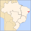
10°17′31″S 36°18′21″W / 10.29194°S 36.30583°W Feliz Deserto is a municipality located in the south of the Brazilian state of Alagoas. Its population is 4,779 (2020)[1] and its area is 92 km².[2]
References
- ^ IBGE 2020
- ^ IBGE - "Archived copy". Archived from the original on January 9, 2007. Retrieved August 3, 2014.
{{cite web}}: CS1 maint: archived copy as title (link)

