
Carney, Oklahoma: Difference between revisions
Rescuing 2 sources and tagging 0 as dead. #IABot (v1.5beta) |
Red Director (talk | contribs) |
||
| (37 intermediate revisions by 20 users not shown) | |||
| Line 1: | Line 1: | ||
{{Use mdy dates|date=May 2024}} |
|||
{{Infobox settlement |
{{Infobox settlement |
||
| |
|name = Carney, Oklahoma |
||
|settlement_type = [[Town]] |
|settlement_type = [[Town]] |
||
|nickname = |
|nickname = |
||
|motto = |
|motto = |
||
<!-- Images --> |
<!-- Images --> |
||
|image_skyline = |
|image_skyline = |
||
| |
|image_caption = |
||
| |
|image_flag = |
||
| ⚫ | |||
|image_seal = |
|image_seal = |
||
| Line 15: | Line 15: | ||
|image_map = OKMap-doton-Carney.PNG |
|image_map = OKMap-doton-Carney.PNG |
||
|mapsize = 250px |
|mapsize = 250px |
||
|map_caption = Location |
|map_caption = Location within [[Oklahoma]] |
||
|image_map1 = |
|image_map1 = |
||
|mapsize1 = |
|mapsize1 = |
||
|map_caption1 = |
|map_caption1 = |
||
<!-- Location --> |
<!-- Location --> |
||
|coordinates_footnotes = <ref name=gnis/> |
|||
|subdivision_type = [[List of countries|Country]] |
|||
| ⚫ | |||
| ⚫ | |||
| |
|subdivision_type = [[List of sovereign states|Country]] |
||
| ⚫ | |||
|subdivision_type1 = [[U.S. state|State]] |
|||
|subdivision_name1 = [[Oklahoma]] |
|subdivision_name1 = [[Oklahoma]] |
||
|subdivision_type2 = [[List of counties in Oklahoma|County]] |
|subdivision_type2 = [[List of counties in Oklahoma|County]] |
||
|subdivision_name2 = [[Lincoln County, Oklahoma|Lincoln]] |
|subdivision_name2 = [[Lincoln County, Oklahoma|Lincoln]] |
||
|subdivision_type3 = [[List of Oklahoma townships|Township]] |
|||
|subdivision_name3 = |
|||
<!-- |
<!-- Established --> |
||
| |
|established_title = Founded |
||
| ⚫ | |||
| ⚫ | |||
| ⚫ | |||
| ⚫ | |||
| ⚫ | |||
|established_title = |
|||
|established_date = |
|established_date = |
||
|established_title1 = [[Platted]] |
|||
|established_date1 = |
|||
|established_title2 = [[Municipal corporation|Incorporated]] |
|||
|established_date2 = |
|||
| ⚫ | |||
<!-- Government --> |
|||
|government_footnotes = |
|||
| ⚫ | |||
| ⚫ | |||
| ⚫ | |||
<!-- Area --> |
<!-- Area --> |
||
|area_footnotes = <ref name="TigerWebMapServer">{{cite web|title=ArcGIS REST Services Directory|url=https://tigerweb.geo.census.gov/arcgis/rest/services/TIGERweb/Places_CouSub_ConCity_SubMCD/MapServer|publisher=United States Census Bureau|accessdate=September 20, 2022}}</ref> |
|||
|unit_pref = Imperial |
|||
| |
|area_total_sq_mi = 1.72 |
||
| |
|area_land_sq_mi = 1.71 |
||
| |
|area_water_sq_mi = 0.02 |
||
| |
|area_total_km2 = 4.47 |
||
| |
|area_land_km2 = 4.42 |
||
| |
|area_water_km2 = 0.05 |
||
| |
|unit_pref = Imperial |
||
|area_water_sq_mi = 0.0 |
|||
<!-- Elevation --> |
|||
|elevation_footnotes = <ref name=gnis/> |
|||
| ⚫ | |||
<!-- Population --> |
<!-- Population --> |
||
| ⚫ | |||
|population_as_of = [[United States |
|population_as_of = [[2020 United States census|2020]] |
||
| ⚫ | |||
|population_total = |
|population_total = 545 |
||
|pop_est_footnotes = |
|||
| ⚫ | |||
| ⚫ | |||
| ⚫ | |||
| ⚫ | |||
| ⚫ | |||
| ⚫ | |||
<!-- General information --> |
<!-- General information --> |
||
|timezone = [[ |
|timezone = [[Central Time Zone|CST]] |
||
|utc_offset = |
|utc_offset = −6 |
||
|timezone_DST = CDT |
|timezone_DST = CDT |
||
|utc_offset_DST = |
|utc_offset_DST = −5 |
||
| |
|postal_code_type = [[ZIP Code]] |
||
|elevation_m = 333 |
|||
|elevation_ft = 1093 |
|||
| ⚫ | |||
|postal_code_type = [[ZIP code]] |
|||
|postal_code = 74832 |
|postal_code = 74832 |
||
| |
|area_code_type = [[North American Numbering Plan|Area code]] |
||
|area_code = [[Area codes 405 and 572|405/572]] |
|||
|blank_name = [[Federal Information Processing Standard|FIPS code]] |
|blank_name = [[Federal Information Processing Standard|FIPS code]] |
||
|blank_info = 40-12100 <ref name="GR2">{{cite web |url= |
|blank_info = 40-12100 <ref name="GR2">{{cite web |url=https://www.census.gov |publisher=[[United States Census Bureau]] |accessdate=January 31, 2008 |title=U.S. Census website }}</ref> |
||
|blank1_name = [[Geographic Names Information System|GNIS]] |
|blank1_name = [[Geographic Names Information System|GNIS ID]] |
||
|blank1_info = |
|blank1_info = 2413172<ref name=gnis>{{GNIS|2413172}}</ref> |
||
|website = |
|website = |
||
| ⚫ | |||
}} |
}} |
||
'''Carney''' is a town in [[Lincoln County, Oklahoma|Lincoln County]], [[Oklahoma]], |
'''Carney''' is a town in [[Lincoln County, Oklahoma|Lincoln County]], [[Oklahoma]], United States. As of the [[2020 United States census|2020 census]], the population of the town was 545. |
||
==History== |
==History== |
||
On May 19, 2013, an [[Tornado outbreak of May 18–21, 2013|EF3 tornado]] struck the southeastern part of town and nearby rural areas. |
|||
===2013 tornado=== |
|||
On May 19, 2013, a strong Tornado passed by the SE area of Carney. There are reports of one injury and major property damage. |
|||
==Geography== |
==Geography== |
||
Carney is located at {{coord|35|48|21|N|97|0|45|W|type:city}} (35.805857, -97.012481).<ref name="GR1">{{cite web|url=http://www.census.gov/geo/www/gazetteer/gazette.html|publisher=[[United States Census Bureau]]|accessdate=2011-04-23|date=2011-02-12|title=US Gazetteer files: 2010, 2000, and 1990}}</ref> According to the [[United States Census Bureau]], the town has a total area of {{convert|1.8|sqmi|km2}}. |
|||
According to the [[United States Census Bureau]], the town has a total area of {{convert|1.8|sqmi|km2}}. |
|||
==Demographics== |
==Demographics== |
||
{{US Census population |
{{US Census population |
||
|align=left |
|||
|1910= 260 |
|1910= 260 |
||
|1920= 367 |
|1920= 367 |
||
| Line 99: | Line 110: | ||
|2000= 649 |
|2000= 649 |
||
|2010= 647 |
|2010= 647 |
||
|2020= 545 |
|||
|estyear=2015 |
|||
| ⚫ | |||
|estimate=661 |
|||
|estref=<ref name="USCensusEst2015">{{cite web|url=http://www.census.gov/popest/data/cities/totals/2015/SUB-EST2015.html|title=Annual Estimates of the Resident Population for Incorporated Places: April 1, 2010 to July 1, 2015|accessdate=July 2, 2016}}</ref> |
|||
| ⚫ | |||
}} |
}} |
||
| ⚫ | As of the [[census]]<ref name="GR2" /> of 2000, there were 649 people, 252 households, and 183 families |
||
===2000 census=== |
|||
| ⚫ | There were 252 households out of which 34.9% had children under the age of 18 living with them, 53.6% were [[Marriage|married couples]] living together, 14.3% had a female householder with no husband present, and 27.0% were non-families. 24.6% of all households were made up of individuals and 9.1% had someone living alone who was 65 years of age or older. The average household size was 2.58 and the average family size was 3.03. |
||
| ⚫ | As of the [[census]]<ref name="GR2" /> of 2000, there were 649 people, 252 households, and 183 families living in the town. The population density was {{convert|367.4|PD/sqmi|PD/km2|sp=us|adj=off}}. There were 281 housing units at an average density of {{convert|159.1|/sqmi|/km2|sp=us|adj=off}}. The racial makeup of the town was 86.75% [[White (U.S. Census)|White]], 1.08% [[African American (U.S. Census)|African American]], 8.01% [[Native American (U.S. Census)|Native American]], 0.62% from [[Race (United States Census)|other races]], and 3.54% from two or more races. [[Hispanic (U.S. Census)|Hispanic]] or [[Latino (U.S. Census)|Latino]] of any race were 1.23% of the population. |
||
| ⚫ | There were 252 households, out of which 34.9% had children under the age of 18 living with them, 53.6% were [[Marriage|married couples]] living together, 14.3% had a female householder with no husband present, and 27.0% were non-families. 24.6% of all households were made up of individuals, and 9.1% had someone living alone who was 65 years of age or older. The average household size was 2.58 and the average family size was 3.03. |
||
In the town, the population was spread out with 31.0% under the age of 18, 6.8% from 18 to 24, 29.0% from 25 to 44, 23.3% from 45 to 64, and 10.0% who were 65 years of age or older. The median age was 35 years. For every 100 females there were 93.7 males. For every 100 females age 18 and over, there were 88.2 males. |
In the town, the population was spread out, with 31.0% under the age of 18, 6.8% from 18 to 24, 29.0% from 25 to 44, 23.3% from 45 to 64, and 10.0% who were 65 years of age or older. The median age was 35 years. For every 100 females, there were 93.7 males. For every 100 females age 18 and over, there were 88.2 males. |
||
The median income for a household in the town was $27,589, and the median income for a family was $29,688. Males had a median income of $25,972 versus $20,000 for females. The [[per capita income]] for the town was $12,020. About 16.1% of families and 19.6% of the population were below the [[poverty line]], including 23.7% of those under age 18 and 11.9% of those age 65 or over. |
The median income for a household in the town was $27,589, and the median income for a family was $29,688. Males had a median income of $25,972 versus $20,000 for females. The [[per capita income]] for the town was $12,020. About 16.1% of families and 19.6% of the population were below the [[poverty line]], including 23.7% of those under age 18 and 11.9% of those age 65 or over.{{clear left}} |
||
== |
==Education== |
||
The community is served by Carney Public Schools #105 school district. |
|||
* [[May 18–21, 2013 tornado outbreak]] |
|||
==References== |
==References== |
||
| Line 120: | Line 131: | ||
==External links== |
==External links== |
||
* [http://www.carney.k12.ok.us/ Carney Public Schools] |
* [http://www.carney.k12.ok.us/ Carney Public Schools] |
||
* [http://carneycemetery.com/ Carney Cemetery] |
* [https://web.archive.org/web/20130703090258/http://carneycemetery.com/ Carney Cemetery] |
||
* [https://web.archive.org/web/20100728102736/http://digital.library.okstate.edu/encyclopedia/entries/C/CA059.html Encyclopedia of Oklahoma History and Culture - Carney] |
* [https://web.archive.org/web/20100728102736/http://digital.library.okstate.edu/encyclopedia/entries/C/CA059.html Encyclopedia of Oklahoma History and Culture - Carney] |
||
* [https://web.archive.org/web/20121024013411/http://www.library.okstate.edu/okmaps/ Oklahoma Digital Maps: Digital Collections of Oklahoma and Indian Territory] |
* [https://web.archive.org/web/20121024013411/http://www.library.okstate.edu/okmaps/ Oklahoma Digital Maps: Digital Collections of Oklahoma and Indian Territory] |
||
| Line 127: | Line 138: | ||
{{Oklahoma City Metropolitan Area}} |
{{Oklahoma City Metropolitan Area}} |
||
{{Oklahoma}} |
{{Oklahoma}} |
||
{{authority control}} |
|||
[[Category:Oklahoma City metropolitan area]] |
[[Category:Oklahoma City metropolitan area]] |
||
Latest revision as of 23:29, 7 May 2024
Carney, Oklahoma | |
|---|---|
 Location within Oklahoma | |
| Coordinates: 35°48′22″N 97°00′56″W / 35.80611°N 97.01556°W[1] | |
| Country | United States |
| State | Oklahoma |
| County | Lincoln |
| Area | |
| • Total | 1.72 sq mi (4.47 km2) |
| • Land | 1.71 sq mi (4.42 km2) |
| • Water | 0.02 sq mi (0.05 km2) |
| Elevation | 1,050 ft (320 m) |
| Population (2020) | |
| • Total | 545 |
| • Density | 320/sq mi (120/km2) |
| Time zone | UTC−6 (CST) |
| • Summer (DST) | UTC−5 (CDT) |
| ZIP Code | 74832 |
| Area code | 405/572 |
| FIPS code | 40-12100 [3] |
| GNIS ID | 2413172[1] |
Carney is a town in Lincoln County, Oklahoma, United States. As of the 2020 census, the population of the town was 545.
History[edit]
On May 19, 2013, an EF3 tornado struck the southeastern part of town and nearby rural areas.
Geography[edit]
According to the United States Census Bureau, the town has a total area of 1.8 square miles (4.7 km2).
Demographics[edit]
| Census | Pop. | Note | %± |
|---|---|---|---|
| 1910 | 260 | — | |
| 1920 | 367 | 41.2% | |
| 1930 | 328 | −10.6% | |
| 1940 | 283 | −13.7% | |
| 1950 | 277 | −2.1% | |
| 1960 | 227 | −18.1% | |
| 1970 | 396 | 74.4% | |
| 1980 | 622 | 57.1% | |
| 1990 | 558 | −10.3% | |
| 2000 | 649 | 16.3% | |
| 2010 | 647 | −0.3% | |
| 2020 | 545 | −15.8% | |
| U.S. Decennial Census | |||
2000 census[edit]
As of the census[3] of 2000, there were 649 people, 252 households, and 183 families living in the town. The population density was 367.4 inhabitants per square mile (141.9/km2). There were 281 housing units at an average density of 159.1 per square mile (61.4/km2). The racial makeup of the town was 86.75% White, 1.08% African American, 8.01% Native American, 0.62% from other races, and 3.54% from two or more races. Hispanic or Latino of any race were 1.23% of the population.
There were 252 households, out of which 34.9% had children under the age of 18 living with them, 53.6% were married couples living together, 14.3% had a female householder with no husband present, and 27.0% were non-families. 24.6% of all households were made up of individuals, and 9.1% had someone living alone who was 65 years of age or older. The average household size was 2.58 and the average family size was 3.03.
In the town, the population was spread out, with 31.0% under the age of 18, 6.8% from 18 to 24, 29.0% from 25 to 44, 23.3% from 45 to 64, and 10.0% who were 65 years of age or older. The median age was 35 years. For every 100 females, there were 93.7 males. For every 100 females age 18 and over, there were 88.2 males.
The median income for a household in the town was $27,589, and the median income for a family was $29,688. Males had a median income of $25,972 versus $20,000 for females. The per capita income for the town was $12,020. About 16.1% of families and 19.6% of the population were below the poverty line, including 23.7% of those under age 18 and 11.9% of those age 65 or over.
Education[edit]
The community is served by Carney Public Schools #105 school district.
References[edit]
- ^ a b c U.S. Geological Survey Geographic Names Information System: Carney, Oklahoma
- ^ "ArcGIS REST Services Directory". United States Census Bureau. Retrieved September 20, 2022.
- ^ a b "U.S. Census website". United States Census Bureau. Retrieved January 31, 2008.
External links[edit]
- Carney Public Schools
- Carney Cemetery
- Encyclopedia of Oklahoma History and Culture - Carney
- Oklahoma Digital Maps: Digital Collections of Oklahoma and Indian Territory
Municipalities and communities of Lincoln County, Oklahoma, United States | ||
|---|---|---|
| Cities | 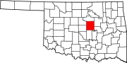 | |
| Towns | ||
| Unincorporated communities | ||
| Ghost towns | ||
| Footnotes | ‡This populated place also has portions in an adjacent county or counties | |