Burmarsh: Difference between revisions
Content deleted Content added
m robot Adding: nl:Burmarsh |
Refine coord |
||
| Line 1: | Line 1: | ||
{{ |
{{Infobox UK place |
||
| ⚫ | |||
| ⚫ | |||
| ⚫ | |||
|static_image = [[Image:All Saints, Burmarsh, Kent.jpg|240px]] |
|static_image = [[Image:All Saints, Burmarsh, Kent.jpg|240px]] |
||
|static_image_caption=All Saints church |
|static_image_caption=All Saints church |
||
| Line 10: | Line 7: | ||
|shire_county = [[Kent]] |
|shire_county = [[Kent]] |
||
|region= South East England |
|region= South East England |
||
| ⚫ | |||
| ⚫ | |||
| ⚫ | |||
| ⚫ | |||
| ⚫ | |||
|post_town= Romney Marsh |
|post_town= Romney Marsh |
||
|postcode_district = TN29 |
|postcode_district = TN29 |
||
Revision as of 19:22, 26 March 2011
| Burmarsh | |
|---|---|
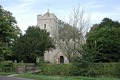
 All Saints church | |
| District | |
| Shire county | |
| Region | |
| Country | England |
| Sovereign state | United Kingdom |
| Post town | Romney Marsh |
| Postcode district | TN29 |
| Police | Kent |
| Fire | Kent |
| Ambulance | South East Coast |
| UK Parliament | |
Burmarsh is a village[1] and civil parish in the Shepway District of Kent, England. The village is located three miles (4.8km) west of Hythe on the Romney Marsh.

