Feliz Deserto: Difference between revisions
Content deleted Content added
m Bot: Migrating 13 interwiki links, now provided by Wikidata on d:q649495 (Report Errors) |
|||
| Line 10: | Line 10: | ||
{{Alagoas-geo-stub}} |
{{Alagoas-geo-stub}} |
||
[[zh:Feliz Deserto]] |
|||
Revision as of 10:41, 16 March 2013
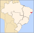
10°17′31″S 36°18′21″W / 10.29194°S 36.30583°W Feliz Deserto is a municipality located in the south of the Brazilian state of Alagoas. Its population is 4,085 (2005) and its area is 92 km².[1]

