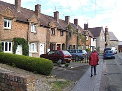
Bengeworth
| Bengeworth | |
|---|---|
 | |
Location within Worcestershire | |
| OS grid reference | SP045430 |
| • London | 88 miles (142 km) |
| District | |
| Shire county | |
| Region | |
| Country | England |
| Sovereign state | United Kingdom |
| Post town | EVESHAM |
| Postcode district | WR11 |
| Dialling code | 01386 |
| Police | West Mercia |
| Fire | Hereford and Worcester |
| Ambulance | West Midlands |
Bengeworth is a locality adjoining Evesham in Worcestershire, England. In 1887 it had a population of 1,311.[1] Today it has a school[2] and an Anglican church.[3]
History
Bengeworth is near the site of an early Romano-British settlement. An Celtic Iron Age gold stater was found near Bengeworth. Anglo-Saxon burial sites are located nearby.[4]
Bengeworth was an early hamlet in one of the three Anglo-Saxon hundreds (Cuthburgelow, Winburgetreow and Wulfereslaw) that were combined to form the triple hundred of Oswaldslow.[5] The etymology indicates that Bengeworth may have been a named location in Anglo-Saxon England as early as the Kingdom of the Hwicce, which was subsumed into the Kingdom of Mercia. From 927, the Kingdom of England ruled the land.
Prior to the Conquest of 1066, Bengeworth was in the triple hundred of Oswaldslow, owned by Evesham Abbey and the Bishop of Worcester.[6] Due to prompt intercession by the abbot, Evesham Abbey was not reduced by William the Conqueror. By 1086, Evesham Abbey owned the entirety of Bengeworth (scribed in Domesday once as Beningeorde (cf. Old English: ben (petition, prayer) + ing (pasture)[7] (perhaps heard by the Domesday scribe as Old French: bening = benign, good – from Latin benignus); Old English: eorðe = earth, ground) and once as Bennieworte (cf. Anglo-Saxon: bene = prayer; worð = land, farm, street, public way)),[7] a larger than average hamlet whose inhabitants were a mixture of free, serf and slave.[6][8] Beningwyrde is another early spelling.[9]
Wulfstan II of Worcester, the last surviving pre-Conquest bishop, held the office in 1086 according to the Domesday Book. The Bishops of Worcester continued to exert sac and soc over Bengeworth and other communities in Oswaldslow Hundred until the Dissolution of the Monasteries in the 16th century, six to eight centuries of Catholic ecclesiastical rule. The English Reformation led to the development of the Anglican church in Bengeworth.
The inhabitants of Bengeworth and nearby Evesham were deeply involved in the English Civil War in the early 17th century. Five Parliamentarian soldiers who participated in the horror of the war became convinced of the pacifist theology of the Society of Friends, and met for religious meetings in 1655 at the home of Thomas Cartwright in Bengeworth.[10] Their beliefs greatly disturbed the mainstream religious and secular authorities, which caused their persecution.[10]
Railways
It was served by the nearby Bengeworth railway station on the Gloucester Loop Line on the Midland Railway between Ashchurch and Evesham. Bengeworth railway station was not in Bengeworth, but rather was the station in the centre in the nearby village of Hampton. The railway station was called 'Bengeworth' as that was considered a distinctive name, while 'Hampton' is a common England village name.
The station opened 1 October 1864.[11] It closed in 1953, but trains continued to use the line until closure in 1963.
References
- ^ Bartholomew’s Guide
- ^ Bengeworth First School Archived October 31, 2007, at the Wayback Machine
- ^ War memorial at St Peter’s Archived September 21, 2005, at the Wayback Machine
- ^ https://www.archiuk.com/cgi-bin/web-archi.pl?ARCHIFormFreeSearch=WR116TH&SearchType=freesearch&distance=10000&postcode=WR116TH ARCHI MAPS database. Accessed April 2020.
- ^ Map of Cuthburgelow, Winburgetreow and Wulfereslaw Hundreds, St. Oswald of Worcester: Life and Influence, ed. Nicholas Brooks, Catherine Cubitt; pub. A&C Black, 1 January 1996, page 170. Accessed April 2020.
- ^ a b https://opendomesday.org/place/SP0443/bengeworth/ Open Domesday: Bengeworth], accessed April 2020.
- ^ a b A Dictionary of the Anglo-Saxon Language Volume 1, by Joseph Bosworth, pub. Longmann, 1838 - 721 pages. Accessed April 2020.
- ^ [1] Monasticon Anglicanum: A History of the Abbies and Other Monasteries, Hospitals, Frieries, and Cathedral and Collegiate Churches, with Their Dependencies, in England and Wales : Also of All Such Scotch, Irish, and French Monasteries, as Were in Any Manner Connected with Religious Houses in England, Volume 2. March 1849 - 643 pages; page 3. Accessed April 2020.
- ^ A History of Worchestershire, page 336. Accessed April 2020.
- ^ a b Evesham Friends in the olden time, pub. West, Newman & Company, Printers, 1885 - Quakers - 228 pages; page 58. Accessed April 2020.
- ^ Catford, Nick (28 April 2012). "Bengeworth". Disused Stations.

