
Kostuchna: Difference between revisions
Content deleted Content added
infobox, navbox |
Kobrabones (talk | contribs) No edit summary |
||
| (5 intermediate revisions by 5 users not shown) | |||
| Line 5: | Line 5: | ||
| native_name_lang = <!-- ISO 639-2 code e.g. "pl" for Polish --> |
| native_name_lang = <!-- ISO 639-2 code e.g. "pl" for Polish --> |
||
| settlement_type = [[Katowice]] [[Dzielnica|District]] |
| settlement_type = [[Katowice]] [[Dzielnica|District]] |
||
| image_skyline = |
| image_skyline = Kostuchna collage.jpg |
||
| image_alt = |
| image_alt = |
||
| image_caption = |
| image_caption = |
||
| image_shield = |
| image_shield = |
||
| shield_alt = |
| shield_alt = |
||
| Line 13: | Line 13: | ||
| map_alt = |
| map_alt = |
||
| map_caption = Location of Kostuchna within Katowice |
| map_caption = Location of Kostuchna within Katowice |
||
| coordinates = {{coord|50|11|19.85|N|18|59|28.3|E|region:PL|display=inline,title}} |
|||
| latd = 50 |latm = 11 |lats = 19.85 |latNS = N |
|||
| longd = 18 |longm = 59 |longs = 28.3 |longEW = E |
|||
| coor_pinpoint = |
| coor_pinpoint = |
||
| coordinates_type = |
|||
| coordinates_display = inline,title |
|||
| coordinates_footnotes = |
| coordinates_footnotes = |
||
| coordinates_region = PL |
|||
| subdivision_type = Country |
| subdivision_type = Country |
||
| subdivision_name = {{flag|Poland}} |
| subdivision_name = {{flag|Poland}} |
||
| Line 56: | Line 52: | ||
| footnotes = |
| footnotes = |
||
}} |
}} |
||
'''Kostuchna''' is a district of [[Katowice]]. It has an area of 8.59 |
'''Kostuchna''' ({{lang-de|Kostuchna}}) is a district of [[Katowice]]. It has an area of 8.59 km<sup>2</sup> and in 2007 had 8,233 inhabitants.<ref name="studium">{{cite web| url = http://bip.um.katowice.pl/dokumenty/2009/12/30/1262693839.pdf| title = Katowice - Studium uwarunkowań i kierunków zagospodarowania przestrzennego| access-date = 2011-06-16| author = Urząd Miasta Katowice| language = Polish| url-status = dead| archiveurl = https://web.archive.org/web/20111104131333/http://bip.um.katowice.pl/dokumenty/2009/12/30/1262693839.pdf| archivedate = 2011-11-04}}</ref> |
||
<gallery> |
<gallery> |
||
| Line 63: | Line 59: | ||
==References== |
==References== |
||
| ⚫ | |||
{{reflist}} |
|||
{{Reflist}} |
|||
| ⚫ | |||
{{Districts of Katowice}} |
{{Districts of Katowice}} |
||
{{Authority control}} |
|||
[[Category:Districts of Katowice]] |
[[Category:Districts of Katowice]] |
||
Latest revision as of 22:58, 6 January 2023
Kostuchna | |
|---|---|
 | |
 Location of Kostuchna within Katowice | |
| Coordinates: 50°11′19.85″N 18°59′28.3″E / 50.1888472°N 18.991194°E | |
| Country | |
| Voivodeship | Silesian |
| County/City | Katowice |
| Area | |
| • Total | 8.59 km2 (3.32 sq mi) |
| Population (2007) | |
| • Total | 8,233 |
| • Density | 960/km2 (2,500/sq mi) |
| Time zone | UTC+1 (CET) |
| • Summer (DST) | UTC+2 (CEST) |
| Area code | (+48) 032 |
Kostuchna (German: Kostuchna) is a district of Katowice. It has an area of 8.59 km2 and in 2007 had 8,233 inhabitants.[1]
-
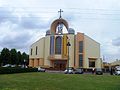 Holy Trinity church
.jpg)
References[edit]
Wikimedia Commons has media related to Kostuchna.
- ^ Urząd Miasta Katowice. "Katowice - Studium uwarunkowań i kierunków zagospodarowania przestrzennego" (PDF) (in Polish). Archived from the original (PDF) on 2011-11-04. Retrieved 2011-06-16.
| I. Central District |
| |
|---|---|---|
| II. Northern District |
| |
| III. Western District | ||
| IV. Eastern District |
| |
| V. Southern District |
| |
This Silesian Voivodeship location article is a stub. You can help Wikipedia by expanding it. |