Santa Luzia do Norte
You can help expand this article with text translated from the corresponding article in Portuguese. Click [show] for important translation instructions.
|
09°36′10″S 35°49′19″W / 9.60278°S 35.82194°W
Santa Luzia do Norte | |
|---|---|
Municipality | |
| The Municipality of Santa Luzia do Norte | |
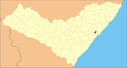
 Location of Santa Luzia do Norte in the State of Alagoas | |
| Coordinates: 09°36′10″S 35°49′19″W / 9.60278°S 35.82194°W | |
| Country | |
| State | |
| Mesoregion | Leste Alagoano |
| Microregion | Maceió |
| Founded | July 23, 1650 |
| Government | |
| • Mayor | Deraldo Romão de Lima (PTB) |
| Area | |
| • Total | 28.541 km2 (11.020 sq mi) |
| Population (2020) | |
| • Total | 7,320 |
| • Density | 260/km2 (660/sq mi) |
| Time zone | UTC−3 (BRT) |
| Area code | +55 82 |
| HDI (2000) | 0.632 – medium[1] |
| Website | Official website |
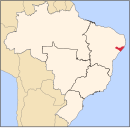
Santa Luzia do Norte is a municipality located in the Brazilian state of Alagoas. Its population was 7,320 (2020)[2] and its area is 29 km2,[3] which makes it the smallest municipality of Alagoas.


