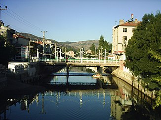
Çarşamba Çayı
| Çarşamba Çayı | ||
|
Çarşamba Çayı in Bozkır |
||
| Data | ||
| location | Konya Province ( Turkey ) | |
| River system | Çarşamba Çayı | |
| Headwaters |
Geyik Dağı 37 ° 6 ′ 43 " N , 32 ° 8 ′ 29" E |
|
| Splitting up | in several irrigation channels coordinates: 37 ° 37 ′ 45 ″ N , 32 ° 49 ′ 13 ″ E 37 ° 37 ′ 45 ″ N , 32 ° 49 ′ 13 ″ E
|
|
| length | 105 km | |
| Left tributaries | Beyşehir Canal | |
| Reservoirs flowed through | Apa dam | |
| Medium-sized cities | Bozkır , Çumra | |
| Communities | Derekoy, Çağlayan | |
The Çarşamba Çayı is a river in the Turkish province of Konya .
The Çarşamba Çayı rises in the northern foothills of the Geyik Dağı , a mountain range of the Taurus Mountains in the south of the Konya province. Initially it flows north. At Derekoy he turns east. It passes Çağlayan and reaches the city of Bozkır . Then the Çarşamba Çayı flows in a north-northwest direction. It meets the Beyşehir Canal , the outflow of the Beyşehir Gölü Lake . The Çarşamba Çayı now flows through the Mavi Boğaz gorge in an easterly direction. The river is later dammed by the Apa dam . The Çarşamba Çayı now flows in a north-northeast direction and crosses the eastern suburbs of Çumra . The natural course of the river ends about 10 km north of Çumra. The Çarşamba Çayı splits into several irrigation channels. The Çarşamba Çayı has a length of 105 km.
