Överuman
| Överuman Uman, Umbukta |
|||||
|---|---|---|---|---|---|
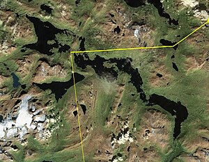
| NASA World Wind satellite image of Överuman | |||||
|
|||||
|
|
|||||
| Coordinates | 66 ° 5 '51 " N , 14 ° 47' 14" E | ||||
| Data on the structure | |||||
| Power plant output: | 27 MW | ||||
| Operator: | Skellefteå force | ||||
| Data on the reservoir | |||||
| Altitude (at congestion destination ) | 523.8 m | ||||
| Water surface | 84.47 km² | ||||
| Reservoir length | 30 km | ||||
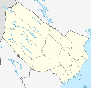
The Överuman or Uman is a dammed lake on the Norwegian / Swedish border. It has an area of 84.47 km² and is at an altitude of 523.8 m. The water level can vary between 520 and 525 m. Most of the lake is located in Sweden, in the province of Västerbottens län , around 160 km northwest of Storuman , a smaller part (3.17 km²) near Rana in the Norwegian province of Nordland . The Norwegian part of the lake is known as Umbukta . Europastraße 12 runs along the north-eastern shore of the lake .
A pressure tunnel leads from the reservoir to the downstream cliff power plant . This was put into operation in 1994 and has an installed capacity of 27 MW, an annual output of 100 GWh and a head of 65 m.
Individual evidence
- ↑ SMHI - Sjöareal och sjöhöjd (PDF; 3.5 MB)
- ↑ Store norske leksikon : Umbukta ( Norwegian ) Retrieved on December 15, 2011th
- ↑ Skellefteå Kraft - Umeälven cliffs ( Memento from June 25, 2013 in the Internet Archive ) (PDF; 292 kB)

