Ain Oussera
|
عين وسارة Ain Oussera |
||
|---|---|---|
|
|
||
| Coordinates | 35 ° 27 ' N , 2 ° 54' E | |
| Basic data | ||
| Country | Algeria | |
| Djelfa | ||
| ISO 3166-2 | DZ-17 | |
| height | 687 m | |
| Residents | 98,107 (2008 Census) | |
|
Cityscape
|
||
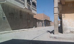
Ain Oussera ( Arabic عين وسارة) is a municipality in the province of Djelfa in the north of Algeria with 98,107 inhabitants (as of 2008). The city is located 200 km south of the capital Algiers and is crossed by main road 1 of the Trans-Sahara Highway .
climate
According to the Köppen and Geiger climate classification , Ain Oussera has a semi-arid climate ( BSk ). Months with the highest average low temperature are July and August (19 ° C). The coldest month (with the lowest average low temperature) is January (1 ° C).
Population development
| Census year | population |
|---|---|
| 1977 | 17.173 |
| 1987 | 44,270 |
| 1998 | 81,145 |
| 2008 | 98.107 |
economy
The economic activities relate mainly to sheep breeding or agriculture in the nearby Sersou plain, tertiary activities and retail trade.
Individual evidence
- ↑ Yu Media Group doo: Ain Oussera, Algeria - Detailed climate information and monthly weather forecast. Retrieved May 17, 2020 .
- ↑ Algeria: Provinces & Cities - Population Statistics, Maps, Charts, Weather, and Web Information. Retrieved May 16, 2020 .


