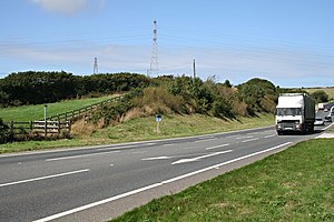
A39 road
| A39 road in the UK | |

|
|
| map | |
| Basic data | |
| Operator: | |
| Start of the street: | Corston (Somerset) |
| End of street: | Falmouth (Cornwall) |
| Overall length: | 318 km (197.6 mi ) |
| The road at Carland Cross in Cornwall | |
The A39 road ( English for ' A39 road ') is a road in the south west of England . It runs from Corston in Somerset via Barnstaple in Devon to Falmouth in Cornwall . After the junction with the A361 in the North Devon district , the road is also called the Atlantic Highway and has been classified as a motorway-like road since 2002 .
Web links
Commons : A39 - collection of pictures, videos and audio files

