A72 road
| A72 road in the UK | |

|
|
| map | |
| Basic data | |
| Operator: | |
| Start of the street: | Galashiels |
| End of street: | Hamilton (South Lanarkshire) |
| Overall length: | 101 km (62.8 mi ) |
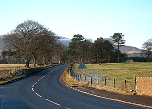
| The A72 in Wolfclyde (photo 2008) | |
The A72 road ( English for road A72 ) is a 101 km long, not designated as a primary route road in Scotland, which connects Galashiels with Hamilton (South Lanarkshire) .
course
The road branches off from the A7 road to the west in Galashiels , leads in the Tweed Valley via Innerleithen to Peebles , where the A703 road branches off to the north, and on via Kirkurd, where the A701 road joins and shortly afterwards the A721 road branches off Biggar . There it runs for a while with the A702 road , which is classified as the primary route, but separates from it again and joins the A73 road after approx. 13 km , with which it leads to Lanark . It leaves Lanark south of the A73, follows the Clydesdale , crosses the A71 road and the M74 motorway at its junction 7 and ends in Hamilton (South Lanarkshire) on the A723 road .


