A887 road
| A887 road in the UK | ||||||||||||||||||||||||||||

|
||||||||||||||||||||||||||||
| map | ||||||||||||||||||||||||||||
| Basic data | ||||||||||||||||||||||||||||
| Operator: | ||||||||||||||||||||||||||||
| Start of the street: |
Invermoriston ( 57 ° 13 ′ N , 4 ° 37 ′ W ) |
|||||||||||||||||||||||||||
| End of street: | Moriston Bridge ( 57 ° 9 ′ N , 4 ° 58 ′ W ) |
|||||||||||||||||||||||||||
| Overall length: | 23.2 km (14.4 mi ) | |||||||||||||||||||||||||||
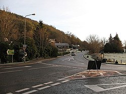
| The junction of the A887 from the A82 in Invermoriston | ||||||||||||||||||||||||||||
|
Course of the road
|
||||||||||||||||||||||||||||
The A887 is an A-road in the Scottish Council Area Highland . It creates a cross connection north of the Great Glen between the A82 and the A87, making it the shortest connection between Inverness and the Isle of Skye on the Scottish west coast. Its course largely corresponds to a Parliamentary Road laid out by Thomas Telford at the beginning of the 19th century .
course
In Invermoriston , a small town on the west bank of Loch Ness , the A887 branches off from the A82. It leads from there in a westerly direction through the Glen Moriston , the valley of the River Moriston . The A887 runs along the north bank of the River Moriston to about halfway to the Torgyle Bridge . You will pass the dammed Loch Dundreggan and the Glenmoriston Power Station , a hydroelectric power station which is the lowest part of the Glenmoriston project in the Great Glen hydro scheme , a series of reservoirs and power stations along the Glen Moriston. To the west the road passes the small settlement of Dundreggan , followed by the junction to the village of Dalchreichart . Shortly after this junction, the A887 crosses the River Moriston on the Torgyle Bridge , a three-arched stone arch bridge originally built by Thomas Telford in the early 19th century . The current bridge was built in 1823 to a design by the engineer Joseph Mitchell after the Telford Bridge was badly damaged in a flood in 1818. It was included in the Scottish List of Monuments in 1971 in the highest category A. The A887 runs in one lane on the narrow bridge, otherwise the road is consistently two-lane.
A few kilometers further west, the A887 crosses the River Moriston again and changes from its south bank to the north side. Shortly after this crossing, the A887 joins the A87 at Moriston Bridge. Originally the A887 ran a few kilometers further west, along the north bank from Loch Cluanie to the Cluanie Inn and only met the A87 there. The damming of Loch Loyne , south of Loch Cluanie, as part of the Great Glen hydro scheme in the 1950s, however, required a new routing of the A87 which had previously run there. This therefore received a new route further east to the Moriston Bridge and from there took over the westernmost section of the A887 to Cluanie Inn.
Web links
Individual evidence
- ↑ Entry on Torgyle Bridge in Canmore, the database of Historic Environment Scotland (English)
- ↑ Listed Building - Entry . In: Historic Scotland .

