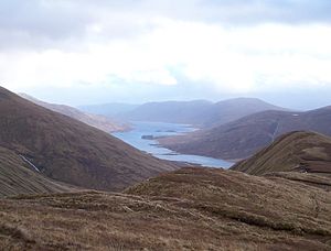
Loch Cluanie
| Loch Cluanie | |||||||
|---|---|---|---|---|---|---|---|
| Loch Cluanie | |||||||
|
|||||||
|
|
|||||||
| Coordinates | 57 ° 8 ′ 40 ″ N , 5 ° 5 ′ 30 ″ W | ||||||
| Data on the structure | |||||||
| Construction time: | -1957 | ||||||
| Height of the barrier structure : | 40 m | ||||||
| Crown length: | 675 m | ||||||
| Data on the reservoir | |||||||
| Reservoir length | 10 km | ||||||
| Reservoir width | 800 m | ||||||
Loch Cluanie is a reservoir in the Scottish Highlands . It is located in Kintail about 20 km west of Fort Augustus between Loch Ness and Loch Duich . Loch Cluanie is about ten kilometers long and about 800 meters wide.
Loch Cluanie is used to generate electricity from hydropower. The lake was dammed in the 1950s as part of the Glenmoriston Hydroelectric Project operated by the North of Scotland Hydro-Electric Board . The dam is 675 m long and around 40 m high.
The well-developed A87 runs along the north bank of the lake . The south bank is not accessed by any road. On this side only a small cul-de-sac leads to the Cluanie Lodge. The area around the lake is very popular with hikers.
Web links
Commons : Loch Cluanie - Collection of images, videos and audio files


