Abres
| Vegadeo municipality: Parroquia Abres | ||
|---|---|---|
| coat of arms | Map of Spain | |
 Help on coat of arms |
|
|
| Basic data | ||
| Autonomous Community : |
|
|
| Coordinates | 43 ° 26 ′ N , 7 ° 6 ′ W | |
| Height : | 70 msnm | |
| Area : | 10.49 km² | |
| Residents : | 217 (2011) INE | |
| Population density : | 20.69 inhabitants / km² | |
| Area code: | 33074010000 | |
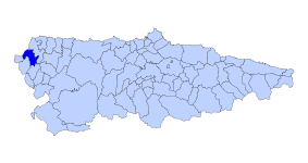
| Location of the municipality | ||

|
||
Abres is one of 6 parroquias in the municipality of Vegadeo in the autonomous region of Asturias in Spain .
The Parroquia is located “to the right” (east) of the Río Eo and includes the hamlets : Las Aceñas, La Curuxeira, La Abraira, El Molín, La Antigua, Grandamea, El Pividal, La Ponte, La Rúa. The next larger town is Vegadeo , the main town of the municipality of the same name, 5.7 km away.
climate
Pleasantly mild summers and also mild, rarely severe winters. In the high areas, winters can be quite severe.
Worth seeing
- Iglesia de Santiago
- Palacio del Pividal
Web links
- Page by Abres ( Memento of March 2, 2012 in the Internet Archive )
