Guiar (Parroquia)
| Vegadeo municipality: Parroquia Guiar | ||
|---|---|---|
| coat of arms | Map of Spain | |
 Help on coat of arms |
|
|
| Basic data | ||
| Autonomous Community : |
|
|
| Comarca : | Eo-Navia | |
| Coordinates | 43 ° 25 ′ N , 7 ° 5 ′ W | |
| Height : | 214 msnm | |
| Area : | 5.55 km² | |
| Residents : | 44 (2011) INE | |
| Population density : | 7.93 inhabitants / km² | |
| Postal code : | 33779 | |
| Area code: | 33074020000 | |
| Nearest airport : | Asturias airport 122 km | |
| administration | ||
| Address of the municipal administration: | Plaza Ayuntamiento, 1 (panes), 33770 VEGADEO | |
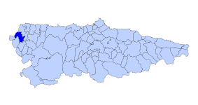
| Location of the municipality | ||

|
||
Guiar is one of six parroquias in the municipality of Vegadeo in the autonomous region of Asturias in Spain .
geography
Guiar is a Parroquia with 44 inhabitants (2011) and an area of 5.55 km². It is at 214 m. The next larger town is Vegadeo , 9.4 km away the main town of the municipality of the same name.
The Río Ouria, a tributary of the Río Eo, flows through the Parroquia .
climate
Pleasantly mild summers with mild, rarely severe winters. In the high areas, winters can be quite severe.
Hamlet in the Parroquia
swell
- Population figures see INE
- For height information, see Google Earth
- Postcodes [1]
