
Adi (island)
| Adi | ||
|---|---|---|
| Waters | Seramsee , Arafura lake | |
| Geographical location | 4 ° 11 ′ S , 133 ° 26 ′ E | |
|
||
| length | 44 km | |
| width | 7 km | |
| surface | 158 km² | |
| Highest elevation | 200 m | |
| main place | Manggawitu | |

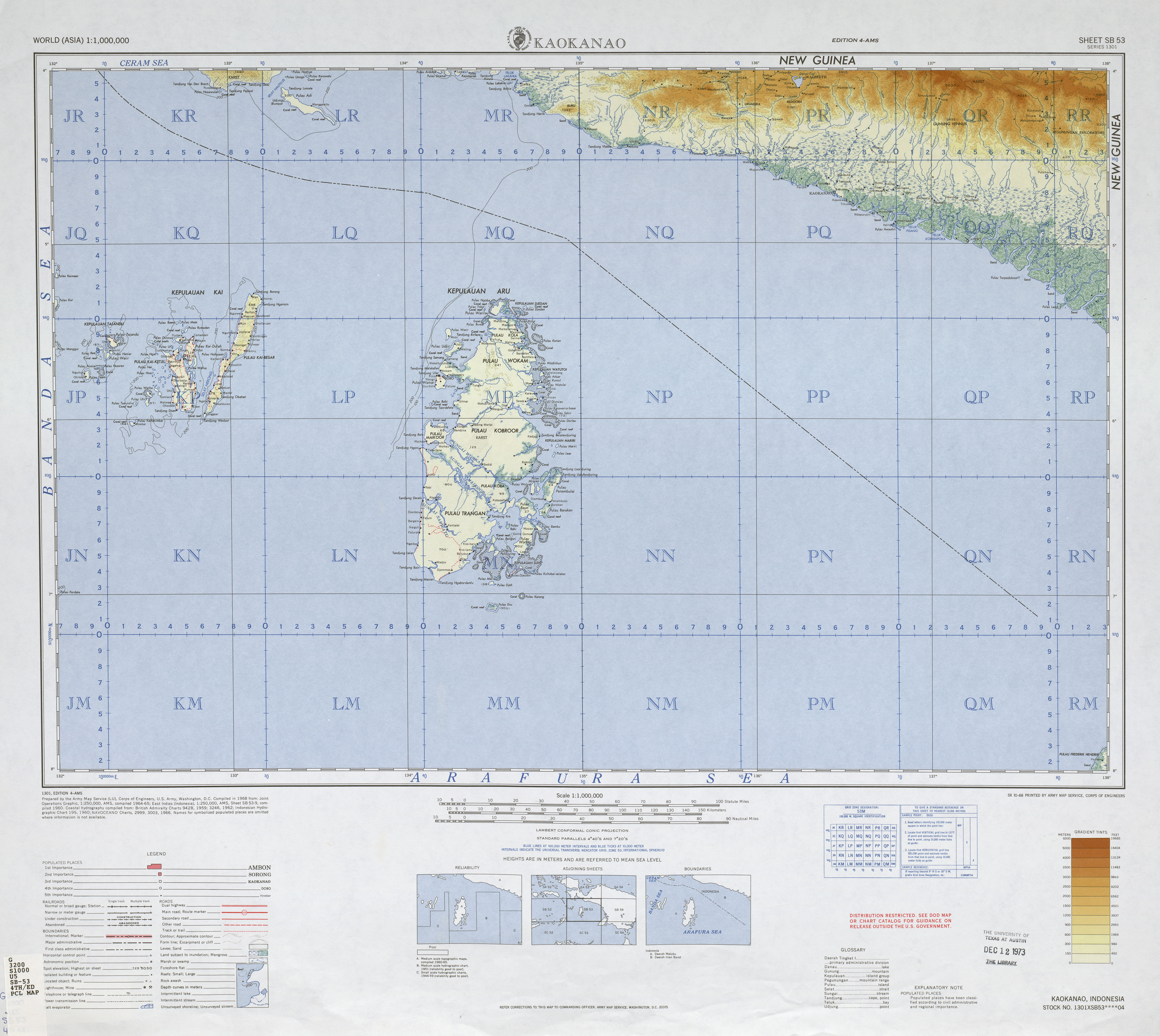
Adi ( Indonesian Pulau Adi ) is off the coast of New Guinea situated Indonesian island . It is located south of the westernmost part of the second largest island on earth in the Seram Sea , a tributary of the Pacific Ocean , on the border with the Arafura Sea . From the coast of the Bomberai Peninsula , which belongs to New Guinea , Adi is separated by the Nautilus Strait ( Indonesian Selat Nautilus ); the distance to the main island is almost 10 km at the narrowest point. Adi represents the southern end of the Kamrau Bay (Indonesian. Teluk Kamrau ) to the north towards the open Seramsee. It is located 450 km south of the equator. Adi belongs to the Indonesian province of Papua Barat ( West Papua ) and is part of the administrative district ( kabupaten ) Kaimana .
Adi has an area of 158 km² and reaches an altitude of 200 meters in the northwest. The island has a length of 44 km and is 7 km wide at its widest point. Its coastline is about 100 km. It extends in a north-west-south-east direction from the Bomberai Peninsula into the open Seram Sea. The characteristic elongated shape of Adis is divided into a wider main part (about two thirds of the island's length) and a narrow, finger-like peninsula adjoining it in the southeast, which takes up about a third of the length. The southeast end forms the Watukebo Cape (indones. Tanjung Watukebo ). The coasts of Adi are largely surrounded by offshore coral reefs .
The natural vegetation on Adi consists of tropical rainforest , in the western and central part of the island there are some agriculturally cleared areas. The main town is Manggawitu , which is centrally located on the north coast .
In Adi, Kowiai , a small Austronesian language, is spoken. In addition, a Creole Papuan variant of Malay and, increasingly, the official language Bahasa Indonesia are used.
Individual evidence
- ↑ a b Special Publication S-23 _1953_.doc (PDF; 994 kB) Retrieved June 18, 2010.
- ↑ a b UNEP Islands Directory (English)
- ↑ International Map of the World, sheet SB-53 . Retrieved June 18, 2010.
- ↑ Language maps of Indonesia (Papua) . Ethnologue.com. Retrieved June 18, 2010.
- ↑ Ethnologue report for language code: kwh . Ethnologue.com. Retrieved June 18, 2010.