Alpilles
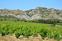
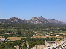
The Alpilles ( French Massif des Alpilles ; German Alpilles ) are a limestone chain in the southwest of Provence between Avignon , Cavaillon and Arles . They extend about 30 kilometers from west to east and about 10 kilometers from north to south, and they reach altitudes of 300 to 500 meters. The region around the Alpilles covers an area of around 500 square kilometers. The highest point is the Tour des Opies (498 m). The heavily jagged mountain ranges stand out brightly against the blue sky , which is particularly clear in Mistral .
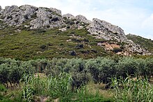
The mountain peaks are bare and only occasionally covered with vegetation from the maquis . One of the largest olive growing areas in France is located on the southern side of the Alpilles . Numerous olive oil mills in the Vallée-des-Baux around Mouriès and Maussane-les-Alpilles produce one of the best olive oils in the world. In addition, here is cultivation of red and rose wines operated. In February 2007 the Alpilles were declared a regional nature park and placed under protection. The aim is to maintain a regional habitat within the framework of a 12-year plan for sustainable development, the natural and cultural heritage of which is acutely threatened.
The main attractions are
- the Regional Natural Park of Alpilles
- the Roman city of Glanum , near today's city of Saint-Rémy-de-Provence
- the place Les Baux-de-Provence
- the museum and the old church of Eygalières
Web links
- Website of the Alpilles National Park
- Website National Parks in France ( Memento from April 25, 2015 in the Internet Archive )
Individual evidence
- ↑ http://www.ville-saint-martin-de-crau.fr/Regionaler-Naturpark-der-Alpillen.html?retour=back
- ↑ http://www.parc-alpilles.fr/
- ↑ http://www.suspiron.ch/01deutsch/alpillen_d.htm
Web links
Coordinates: 43 ° 45 ' N , 4 ° 50' E


