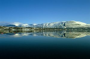
Altevatnet
| Altevatnet | |||||
|---|---|---|---|---|---|
| Altevatnet | |||||
|
|||||
|
|
|||||
| Coordinates | 68 ° 29 '39 " N , 19 ° 42' 49" E | ||||
| Data on the structure | |||||
| Height above the river bed : | 99 m | ||||
| Data on the reservoir | |||||
| Altitude (at congestion destination ) | 489 m | ||||
| Water surface | 79.71 km² | ||||
| Reservoir length | 35 km | ||||
| Reservoir width | 2 km | ||||
| Storage space | 1,027 million m³ | ||||
Altevatnet is an 80 km² reservoir in the municipality of Bardu in the province of Troms og Finnmark in Norway, north of the smaller lake Geavdnjajávri and the Swedish Torneträsk .
It is the eleventh largest lake in Norway and the largest in the former province of Troms . It is 35 km long and an average of 2 km wide.
The lake is provided with a dam closure that regulates the altitude between 472 and 489 moh . Its outflow is the Barduelva , which flows into the Målselva , which in turn flows into the Målselvfjord , a branch of the Malangsfjord . The power plants Innset, Straumsmo in Bardu and Bardufoss along the Barduelva use the Altevatnet water reservoir with 1,027 million m³. It is connected to the Leinavatn by the Ousto Canal on its east side .
Web links
- "De største innsjøene i Norge" Norges vassdrags- og energidirektorat (NVE), official ranking list (Norwegian)

