Amisfield
| Amisfield | ||
|---|---|---|
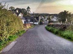
| View over Amisfield | ||
| Coordinates | 55 ° 8 ′ N , 3 ° 34 ′ W | |
|
|
||
| Residents | 119 (1961 census) | |
| administration | ||
| Post town | DUMFRIES | |
| ZIP code section | DG1 | |
| prefix | 01387 | |
| Part of the country | Scotland | |
| Council area | Dumfries and Galloway | |
| British Parliament | Dumfriesshire, Clydesdale and Tweeddale | |
| Scottish Parliament | Dumfriesshire | |
Amisfield is a town in the Scottish council area Dumfries and Galloway . It is located about eight kilometers northeast of the center of Dumfries on the Amisfield Burn stream , the upper reaches of Lochar Water .
history
Since the 12th century, the lands were owned by the Charteris clan . The village developed with the Tower House Amisfield Tower , which is isolated around one kilometer northwest of Amisfield. It was one of the fortifications of the Charteris clan, who built it in 1600. A previous structure may have existed at the site. In 1961 there were 119 residents in Amisfield.
traffic
A trunk road runs directly to the east with the A701 ( Edinburgh –Dumfries). In the middle of the 19th century, the village was connected to the railway network with its own train station along the Dumfries, Lochmaben and Lockerbie Railway . However, the station was closed in the 1950s.
Individual evidence
- ↑ a b 1961 census
- ^ Entry in the Gazetteer for Scotland
- ↑ a b Amisfield in: FH Groome: Ordnance Gazetteer of Scotland: A Survey of Scottish Topography, Statistical, Biographical and Historical. , Grange Publishing, Edinburgh, 1885.
- ↑ Listed Building - Entry . In: Historic Scotland .
- ↑ Entry on Amisfield Tower in Canmore, the database of Historic Environment Scotland (English)

