Ammannsbrücke
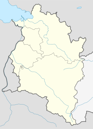
Coordinates: 47 ° 23 '2 " N , 9 ° 47' 22" E
| Ammannsbrücke | ||
|---|---|---|
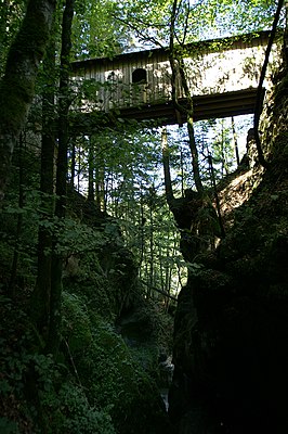
| The Ammannsbrücke seen from the Gunzenach / Kobelach . | ||
| use | Transport, pedestrians | |
| Convicted | Gunzenach / Kobelach | |
| place | Dornbirn | |
| construction | Wood | |
| overall length | 14 m | |
| width | 2.60 m | |
| building-costs | 402 guilders | |
| start of building | 1869 | |
| location | ||
|
|
||
| Above sea level | 710 m above sea level A. | |
The Ammannsbrücke (also Amannsbrücke or Ammansbrücke or Ammansbruck , 710 m above sea level ) in Dornbirn , Gütle , a protected wooden covered bridge , is now a popular hiking destination and is only used to a limited extent for the transport of goods.
The bridge, built in 1869, was built for transport purposes like its predecessor. It is no longer known when the first previous building was built. The bridge was first entered in the land register in 1857 .
The wooden bridge leads at a height of 23 m over part of the Gunzenach / Kobelach , a tributary of the Dornbirner Ach .
Surname
The magistrate , in alemannischen also Ammann , Amann or Amman , had once administrative - and jurisdictional perform tasks in a particular region (see also: Landammann ).
In Vorarlberg, the name Ammann is still often used as a surname (no longer a functional designation) in various spellings . To what extent the bridge can be associated with a certain bailiff is no longer known today.
literature
- Martin Wohlgenannt: Development of the alpine economy on the Dornbirner First: the First through the ages. Vorarlberger Verlagsanstalt, Dornbirn 2002.
Web links
- Renovation of the listed Amannsbrücke completed , December 13, 2011 (Vol.at).
- Hiking trail over Amannsbrücke is well received , November 5, 2012 (Vol.at)

