Amundsen glacier
| Amundsen glacier | ||
|---|---|---|
|
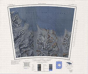
Topographic map sheet Mount Goodale 1: 250,000 with Amundsen Glacier |
||
| location | Ross Dependency , East Antarctica | |
| Mountains | Queen Maud Mountains , Transantarctic Mountains | |
| length | 130 km (roughly estimated) | |
| width | Max. 10 km (roughly estimated) | |
| Coordinates | 85 ° 35 ′ S , 159 ° 0 ′ W | |
|
|
||
| drainage | Ross Ice Shelf | |
The Amundsen Glacier is about 130 km long and up to 10 km wide glacier in the Antarctic Ross Dependency . It flows from the central polar plateau south and west of the Nilsen Plateau to the north through the Queen Maud Mountains and reaches the Ross Ice Shelf in the area of the Amundsen coast west of the MacDonald Nunatakker .
The American polar explorer Richard Evelyn Byrd discovered him during his South Pole flight in November 1929 as part of his first Antarctic expedition (1928–1930). At the suggestion of Laurence McKinley Gould (1896-1995), the chief geologist on this research trip, who had penetrated to the mouth of the glacier on a sledge excursion in December 1929, the glacier was named after the Norwegian polar explorer Roald Amundsen (1872-1928).
Web links
- Amundsen Glacier in the Geographic Names Information System of the United States Geological Survey (English)
- Amundsen Glacier on geographic.org (English)
- Amundsen Glacier. Aerial view facing south on livescience.com


