Amundsen coast
| Amundsen coast | ||
|---|---|---|
|
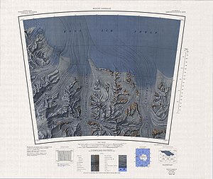
The map sheet shows most of the coast, with the exception of the part west of 165 ° W
|
||
|
|
||
| location | East Antarctica | |
| Waters | Ross Ice Shelf | |
| From |
Morris Peak 84 ° 56 '0 " S , 167 ° 22' 0" W |
|
| To |
Scott Glacier 85 ° 45 ′ 0 ″ S , 153 ° 0 ′ 0 ″ W |
|
Coordinates: 85 ° 30 ′ S , 162 ° 0 ′ W
The Amundsen Coast is a stretch of coast in the Antarctic Ross Dependency . It is located south of the Ross Ice Shelf between the on the eastern side of the mouth of Liv Glacier towering Morris Peak and the west side of the mouth of the Scott Glacier . The Gould Coast , the westernmost part of which is the Scott Glacier, connects to the east , and the Dufek Coast to the west .
The New Zealand Antarctic Place-Names Committee named the coast in 1961 after the Norwegian polar explorer Roald Amundsen (1872-1928), who together with four companions on December 14, 1911 after a dog sled march across the Ross Ice Shelf, the Axel-Heiberg -Glacier and the central polar plateau were the first to reach the geographic South Pole .
Web links
- Amundsen Coast in the Geographic Names Information System of the United States Geological Survey (English)
- Amundsen Coast on geographic.org (English)

