Saunders coast
| Saunders coast | ||
|---|---|---|
|
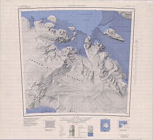
Map sheet showing the section of the Saunders coast north and east of the Edward VII Peninsula
|
||
|
|
||
| location | Marie Byrd Land , West Antarctica | |
| Waters | Southern Ocean (Pacific part) | |
| From |
Cape Colbeck 77 ° 7 ′ 0 ″ S , 158 ° 1 ′ 0 ″ W. |
|
| To |
Brennan Point 76 ° 5 ′ 0 ″ S , 146 ° 31 ′ 0 ″ W. |
|
Coordinates: 78 ° S , 150 ° W
The Saunders Coast is a stretch of coast in the west Antarctic Marie Byrd Land . It lies between Cape Colbeck and Brennan Point . It limits the Edward VII Peninsula to the north. Among other things, Sulzberger Bay and the Guest Peninsula are located on it .
The coast was explored from the air on December 5, 1929 during the Byrd Antarctic Expedition (1928–1930). The resulting aerial photographs were used by the US cartographer Harold Eugene Saunders (1890–1961), who is also the namesake of the coast, for an initial mapping. The United States Geological Survey completed this mapping with its own measurements and aerial photographs by the United States Navy between 1959 and 1965.
Web links
- Saunders Coast in the Geographic Names Information System of the United States Geological Survey (English)
- Saunders Coast on geographic.org (English)

