Ang Sila
|
อ่าง ศิลา Ang Sila |
||
|---|---|---|
|
|
||
| Coordinates | 13 ° 20 ′ N , 100 ° 56 ′ E | |
| Basic data | ||
| Country | Thailand | |
| Chon Buri | ||
| ISO 3166-2 | TH-20 | |
| Residents | 30,981 (2012) | |
| Website | angsilacity.go.th/public/ (Thai) | |
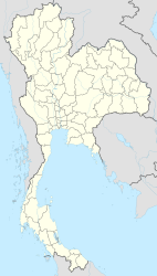
Ang Sila ( Thai : อ่าง ศิลา , full name: เทศบาล เมือง อ่าง ศิลา ), is a city ( Thesaban Mueang ) in the district ( Amphoe ) Mueang Chonburi ( Chonburi Province ) in the eastern region of central Thailand .
The Thai name of Ang Sila means rock basin after a rock formation that extends out into the sea.
Most of the residents of Ang Sila live in a small village on the Gulf of Thailand , about 5 km south of Chonburi. The main source of income is fishing , but stone mortars , decorative stone sculptures such as elephants and lions and weaving are also made here.
Ang Sila is considered to be one of the oldest beach resorts in Thailand. The road leading to the surrounding hills overlooks the sea.
Individual evidence
- ↑ Population statistics 2012 . Department of Provincial Administration. Retrieved March 21, 2014.
- ↑ Official website of the city ( Memento of the original from March 4, 2016 in the Internet Archive ) Info: The archive link was inserted automatically and has not yet been checked. Please check the original and archive link according to the instructions and then remove this notice.
