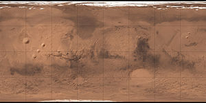
Argyre Planitia
| Martian crater Argyre Planitia | ||
|---|---|---|

|
||
| Topography from the MOLA instrument of the Mars Global Surveyor | ||
|
|
||
| position | 50 ° S , 43 ° W | |
| diameter | 893 km | |
| depth | 5000 m | |
| history | ||
| Age | about 3.9 billion years | |
Argyre Planitia is a circular, vast plain on the southern hemisphere of the planet Mars . Your name is derived from ancient Greek and means something like "silver plane". Argyre Planitia is the third largest impact basin on Mars after Hellas Planitia and Isidis Planitia .
The center of the area is located in 49.4 degrees south latitude and 42.8 degrees west longitude . The plain lies between the highland regions of Aonia Terra and Noachis Terra .
description
Argyre Planitia was formed about 3.9 billion years ago, during the early geological history of the planet, by the impact of an asteroid . The impact basin has a diameter of about 900 km and lies on average 5 km below the surrounding regions. The bottom of the basin has several large impact craters , the largest of which, Martian Hooke Crater ( 44 ° 55 ′ S , 44 ° 24 ′ W ) on its northern edge, has a diameter of 138 km. In the middle of the elevations of the eastern rim of the crater , on the border to Noachis Terra, lies the 224 km large Galle impact crater ( 50 ° 38 ′ S , 31 ° 0 ′ W ). In addition, relatively sharply defined rock formations rise from the plain.
See also
Web links
- Argyre Planitia on Google Mars
- DLR: Crater and dune field in the Argyre Planitia impact basin August 23, 2004
- DLR: Ice-covered beauty on the "Silver Island" of Mars October 4, 2012
- DLR: Traces of water, ice and wind in the Nereidum Montes November 1, 2012
- DLR: Deep winter in Argyre Planitia September 18, 2014

