Arrowrock Dam
| Arrowrock Dam | |||||
|---|---|---|---|---|---|
| Dam wall | |||||
|
|||||
|
|
|||||
| Coordinates | 43 ° 35 '44 " N , 115 ° 55' 20" W | ||||
| Data on the structure | |||||
| Lock type: | Arch dam | ||||
| Construction time: | 1912-1915 | ||||
| Height of the barrier structure : | 106 m | ||||
| Building volume: | 447 000 m³ | ||||
| Crown length: | 351 m | ||||
| Crown width: | 4.5 m | ||||
| Base width: | 68.6 m | ||||
| Power plant output: | 1.5 MW | ||||
| Operator: | United States Bureau of Reclamation | ||||
| Data on the reservoir | |||||
| Water surface | 12.5 km² | ||||
| Storage space | 371 million m³ | ||||
| Catchment area | 5700 km² | ||||
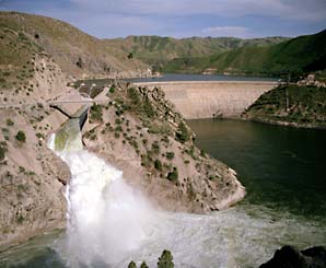
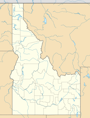
The Arrowrock Dam is a dam with a concrete arch dam as a dam on the Boise River in Idaho , USA. It stands on the border of Boise and Elmore Counties . The main purpose of the dam is irrigation for agriculture. When it was completed in 1915, the dam was 106 meters high (according to some sources and 107 or even 110 m depending on the reference point) the highest on earth, until it was surpassed by the Schräh dam in Switzerland in 1924 .
Planning began in 1910. From 1912, a hydroelectric power station on an auxiliary dam produced 1500 kW of electricity for the construction site. The three turbines came from Germany and were the first with a vertical axis. In 1976 they were listed on the National Register of Historic Places . In 2002 the power house was renovated. The dam was completed on October 4, 1915. In the beginning there were many visitors who were brought up by a train specially built for the dam. In 1916 their operations were closed again after five years due to lack of interest.
Thermometers were installed for the first time during construction to monitor the temperature of the concrete. The concrete was brought to the construction site with a cable crane .
See also
- List of the largest dams on earth
- List of the largest reservoirs on earth
- List of the largest hydroelectric plants in the world
- List of dams in the United States
Web links
- USBR: Arrowrock Dam
- Arrowrock Dam , NPDP Dam Directory

