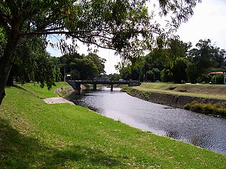
Arroyo Miguelete
| Arroyo Miguelete | ||
| Data | ||
| location | Montevideo Uruguay Department | |
| River system | Río de la Plata | |
| Drain over | Río de la Plata → Atlantic | |
| source | in the Cuchilla de Pereira 34 ° 44 ′ 42 ″ S , 56 ° 10 ′ 17 ″ W. |
|
| muzzle | in the Río de la Plata coordinates: 34 ° 52 ′ 22 ″ S , 56 ° 13 ′ 32 ″ W 34 ° 52 ′ 22 ″ S , 56 ° 13 ′ 32 ″ W.
|
|
| length | 22 km | |
| Catchment area | 113 km² | |
| Left tributaries | Arroyo de Mendoza , Casavalle | |
| Right tributaries | Pajas Blancas | |
The Arroyo Miguelete is a small river in southern Uruguay .
The 22 km long river in the Montevideo department rises in the Cuchilla de Pereira in the north of the department and flows north-south in the Bay of Montevideo into the Río de la Plata . The catchment area of this most important river in the department, which runs in the Montevidean district of Prado - Nueva Savona through the local park with Playa Capurro and, among other things, serves the recreational activities of the residents of Montevideo , covers 113 km².
Nowadays, many irregular settlements have formed on Arroyo Miguelete, especially in the middle section of its course, which ultimately led to increasing pollution problems of the water through their residents, but also through settled industry. The administration of Montevideo is currently trying to counteract this development through planning design.
