Ash Gill
| Ash Gill | ||
|
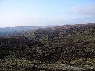
The incision of the Little Gill (left) from Burnhope Seat |
||
| Data | ||
| location | Cumbria | |
| River system | Tyne (England) | |
| source | on the north slope of Burnhope Seat 54 ° 44 ′ 45 ″ N , 2 ° 20 ′ 39 ″ W |
|
| muzzle | in the South Tyne coordinates: 54 ° 45 ′ 24 " N , 2 ° 23 ′ 0" W 54 ° 45 ′ 24 " N , 2 ° 23 ′ 0" W.
|
|
The Ash Gill is a short river in Cumbria , England .
The river, which is also known as Little Gill in its upper reaches and has numerous small tributaries, arises on the northern edge of Burnhope Seat in an area that is characterized by numerous man-made mine shafts as well as natural sinkholes .
The river has a waterfall called Ashgill Force and flows into the South Tyne .


