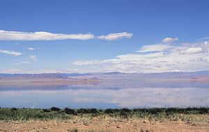
Achit Nuur
| Achit Nuur | ||
|---|---|---|

|
||
| Geographical location | Chowd-Aimag , Bajan-Olgii-Aimag ( Mongolia ) | |
| Tributaries | Mogen-Buren , Altangadas-Gol , Ulijastain-Gol | |
| Drain | Ussun-Cholai → Chowd Gol | |
| Data | ||
| Coordinates | 49 ° 30 ' N , 90 ° 33' E | |
|
|
||
| Altitude above sea level | 1435 m | |
| surface | 290 km² | |
| length | 28 km | |
| width | 16 km | |
| Maximum depth | 10 m | |

|
||
| Satellite image | ||
The Achit Nuur ( Mongolian Ачит нуур ; Russian Ачит-Нуур ) is a freshwater lake in western Mongolia .
The lake extends in a valley framed by mountains at an altitude of 1435 m . The water area is 290 km². It has a longitudinal extension of 28 km and a maximum width of 16 km. The maximum depth is approx. 10 m. A desert landscape stretches along its banks . Only in the northeast does a swamp landscape border the lake shore. The lake is fed by several rivers. In the south, the lake is drained via the Ussun-Cholai to the Chowd Gol .
