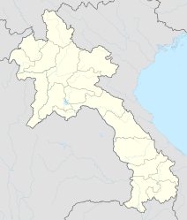
Attapeu
|
ອັດ ຕະ ປື Attapeu |
||
|---|---|---|
|
|
||
| Coordinates | 14 ° 48 ′ N , 106 ° 50 ′ E | |
| Basic data | ||
| Country | Laos | |
| Attapeu | ||
| ISO 3166-2 | LA-AT | |
| height | 93 m | |
| Residents | 19,200 (2005) | |
|
Government building in Attapeu
|
||
Attapeu ( also Attapu ; Lao ອັດ ຕະ ປື - [ âttapʉ̄ ]) is the capital of the Attapeu province in the southeast of Laos . Also known as Samakhi Xai , the city is located in the valley of the Xe Kong River at 93 m asl . The area is only sparsely populated.
Attapeu has an important market for food and daily necessities for the region, as well as the only hospital in the province for basic medical care.
In May 2013, a contract to build an airport was signed with the Vietnamese Hoang Anh Gia Lai Group . It is to be built 26 km from the gates of the provincial capital. This should make the remote region more attractive for tourists and investors.
Web links
Commons : Attapeu - collection of images, videos and audio files
Individual evidence
- ↑ Lonely Planet: Laos, p . 308 . Retrieved November 19, 2013.
- ↑ Deal inked for building of Attapeu airport . Lao Voices from May 13, 2013 (English).
- ↑ New Lao airports planned to push tourism . investvine.com from January 17, 2013 (English).

